The National Geologic Map Database is migrating to a new infrastructure. We apologize for any service disruptions during this process.
|
|---|


- Usage in publication:
-
- Granite Mountain porphyry*
- Modifications:
-
- First used
- Dominant lithology:
-
- Porphyry
- AAPG geologic province:
-
- Basin-and-Range province
Summary:
First published use as a name applied to a quartz monzonite porphyry. Intrudes schist of Granite Mountain. Intent to name or designation of a type not stated. Is white to gray due to preponderance of feldspar and quartz. Is medium grained with phenocrysts of orthoclase and quartz. Most abundant phenocrysts are plagioclase. The groundmass is a fine equigranular aggregate of quartz and clear orthoclase. Average diameter of grain in groundmass is about 1 mm. Also contains small amounts of titanite, apatite, magnetite, and zircon. Closely associated with Teapot Mountain porphyry (first used). Mapped (geologic map) with other granite and granite porphyries in the Basin-and-Range province which are assigned an early Tertiary? age.
Source: GNU records (USGS DDS-6; Denver GNULEX).
- Usage in publication:
-
- Granite Mountain Porphyry*
- Modifications:
-
- Age modified
- AAPG geologic province:
-
- Basin-and-Range province
Summary:
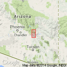
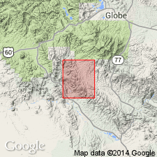
Occurs as small chonolithic masses that cut a Cretaceous and Tertiary porphyry and are cut by Teapot Mountain Porphyry in Pinal Co, AZ in Basin-and-Range province. Age changed from early Tertiary? to Paleocene [probably on basis of K-Ar ages of 63 m.y. and 60 m.y. reported earlier]. Geologic map.
Source: GNU records (USGS DDS-6; Denver GNULEX).
For more information, please contact Nancy Stamm, Geologic Names Committee Secretary.
Asterisk (*) indicates published by U.S. Geological Survey authors.
"No current usage" (†) implies that a name has been abandoned or has fallen into disuse. Former usage and, if known, replacement name given in parentheses ( ).
Slash (/) indicates name conflicts with nomenclatural guidelines (CSN, 1933; ACSN, 1961, 1970; NACSN, 1983, 2005, 2021). May be explained within brackets ([ ]).