The National Geologic Map Database is migrating to a new infrastructure. We apologize for any service disruptions during this process.
|
|---|


- Usage in publication:
-
- Grangeville Member
- Modifications:
-
- Original reference
- Dominant lithology:
-
- Basalt
- AAPG geologic province:
-
- Idaho Mountains province
Summary:
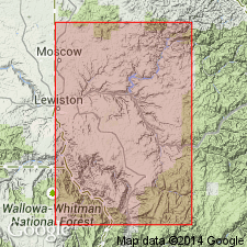
Grangeville Member of Saddle Mountains Basalt of Columbia River Basalt Group. Present only on uplifted Nez Perce platform of the Clearwater embayment in Idaho. Consists of medium- to coarse-grained olivine basalt that erupted from dikes cutting the Nez Perce plateau in Rocky canyon; has reverse magnetic polarity. Overlies the basalt of Weippe in the Pomona Member and underlies Craigmont Member (new), both of Saddle Mountains Basalt. Age is late Miocene.
Type locality: Grangeville, near South Fork of Clearwater River, [Grangeville East 7.5-min quadrangle], Idaho Co., ID.
Source: US geologic names lexicon (USGS Bull. 1565, p. 122); GNU records (USGS DDS-6; Denver GNULEX).
For more information, please contact Nancy Stamm, Geologic Names Committee Secretary.
Asterisk (*) indicates published by U.S. Geological Survey authors.
"No current usage" (†) implies that a name has been abandoned or has fallen into disuse. Former usage and, if known, replacement name given in parentheses ( ).
Slash (/) indicates name conflicts with nomenclatural guidelines (CSN, 1933; ACSN, 1961, 1970; NACSN, 1983, 2005, 2021). May be explained within brackets ([ ]).