The National Geologic Map Database is migrating to a new infrastructure. We apologize for any service disruptions during this process.
|
|---|


- Usage in publication:
-
- Grandstand formation*
- Modifications:
-
- Named
- Dominant lithology:
-
- Sandstone
- Siltstone
- Shale
- AAPG geologic province:
-
- Alaska Northern region
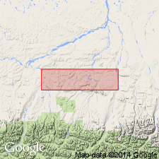
Summary:
Named as marine formation in Nanushuk group. Rocks were formerly lower part of Topagoruk member of Umiat formation. Type locality designated as exposures on left bank of Anaktuvuk River where river breaches Grandstand anticline, 68 deg 56'N, 151 deg 10'W, also location of measured type section, 1700 ft thick. Basal part is predominantly fine-grained light olive-gray to dark-yellow-red sandstone with thin greenish "salt-and-pepper" sandstone and subordinate amounts of siltstone and shale. In upper part, siltstone and silt shale constitute about 50% of unit; minor amounts of coal is in sequence. Unconformably overlies Tuktu formation; underlies and intertongues with Killik tongue (new) of Chandler formation (all of Nanushuk group). Contains fossils. Age shown on chart as Early and Late(?) Cretaceous.
Source: GNU records (USGS DDS-6; Menlo GNULEX).
- Usage in publication:
-
- Grandstand formation*
- Modifications:
-
- Areal extent
- AAPG geologic province:
-
- Alaska Northern region
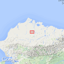
Summary:
Grandstand formation is penetrated from 30 to 2825 ft depth in Oumalik test well 1 and from 730 to 3050 ft depth in East Oumalik test well 1 in Naval Petroleum Reserve No.4, northern AK.
Source: GNU records (USGS DDS-6; Menlo GNULEX).
- Usage in publication:
-
- Grandstand formation*
- Modifications:
-
- Age modified
- Areal extent
- AAPG geologic province:
-
- Alaska Northern region
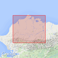
Summary:
Grandstand formation is penetrated from 1235 to 4200 ft depth in Meade test well 1, Naval Petroleum Reserve No.4. Age given as Early Cretaceous [based on occurrence of foraminifers of VERNEUILINOIDES BOREALIS faunal zone of Early Cretaceous age].
Source: GNU records (USGS DDS-6; Menlo GNULEX).
- Usage in publication:
-
- Grandstand formation*
- Modifications:
-
- Areal extent
- AAPG geologic province:
-
- Alaska Northern region
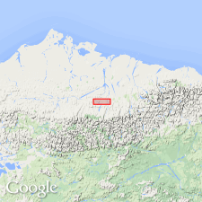
Summary:
Grandstand and Chandler formations, undifferentiated, are penetrated from 110 to 1070 ft depth in Grandstand test well 1, Naval Petroleum Reserve No.4. Age given as Early Cretaceous.
Source: GNU records (USGS DDS-6; Menlo GNULEX).
- Usage in publication:
-
- Grandstand formation*
- Modifications:
-
- Areal extent
- AAPG geologic province:
-
- Alaska Northern region
Summary:
Grandstand formation is penetrated from 1850 to 3500 ft depth in Titaluk test well 1 and also in Knifeblade test wells. Report includes detailed lithologic description and lists of fossils. Age given as Early Cretaceous.
Source: GNU records (USGS DDS-6; Menlo GNULEX).
- Usage in publication:
-
- Grandstand Formation*
- Modifications:
-
- Overview
- Revised
- AAPG geologic province:
-
- Alaska Northern region
Summary:
In Umiat-Maybe Creek area top surface of Grandstand Formation is stratigraphically restricted 325 to 365 ft downwards to use formation as mapping unit. Detailed lithology correlation chart, and paleontological data included in report.
Source: GNU records (USGS DDS-6; Menlo GNULEX).
- Usage in publication:
-
- Grandstand Formation†
- Modifications:
-
- Abandoned
- AAPG geologic province:
-
- Alaska Northern region
Summary:
Pg. 5 (fig. 4), 6-8 (table 1), 12. †Grandstand Formation of Nanushuk Group. Abandoned. Rocks reassigned to unnamed upper part (transitional marine and nonmarine) of Nanushuk Formation (revised). [See Nanushuk.]
Source: Publication.
For more information, please contact Nancy Stamm, Geologic Names Committee Secretary.
Asterisk (*) indicates published by U.S. Geological Survey authors.
"No current usage" (†) implies that a name has been abandoned or has fallen into disuse. Former usage and, if known, replacement name given in parentheses ( ).
Slash (/) indicates name conflicts with nomenclatural guidelines (CSN, 1933; ACSN, 1961, 1970; NACSN, 1983, 2005, 2021). May be explained within brackets ([ ]).