- Usage in publication:
-
- Grandfield conglomerate
- Modifications:
-
- Named
- Dominant lithology:
-
- Conglomerate
- Clay
- Limestone
- AAPG geologic province:
-
- Palo Duro basin
Summary:
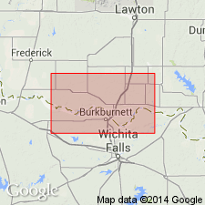
Named as a unit in the Tertiary or Quaternary system; named from the town of Grandfield, Tillman Co, OK in the Palo Duro basin. No type locality designated. Occurs on south rim of hill on which town of Grandfield is built; lies just below the surface at many places in this town; caps a dome shaped hill, Curtis Hill, in N1/2 sec 13, T4S, R15W; found along noses of hills adjacent to most of large tributaries to Deep Red Run from the north. Consists of a thin bed (3 to 4 ft) of peculiar reddish conglomerate which contains a matrix of red clay and limestone with pebbles of quartz, quartzite, and a few of granite, and some fragments of chert, occasional pieces of limestone and silicified wood; pebbles are waterworn, fairly well rounded, with the largest being 3+ inches in diameter. Conglomerate is a compact, indurated bed, surprisingly uniform in character; averages 3-4 ft thick. Grandfield is uniform in composition, appearance, thickness, and hardness throughout district. Everywhere lies unconformably upon the Permian Wichita formation. Geologic maps.
Source: GNU records (USGS DDS-6; Denver GNULEX).
For more information, please contact Nancy Stamm, Geologic Names Committee Secretary.
Asterisk (*) indicates published by U.S. Geological Survey authors.
"No current usage" (†) implies that a name has been abandoned or has fallen into disuse. Former usage and, if known, replacement name given in parentheses ( ).
Slash (/) indicates name conflicts with nomenclatural guidelines (CSN, 1933; ACSN, 1961, 1970; NACSN, 1983, 2005, 2021). May be explained within brackets ([ ]).

