The National Geologic Map Database is migrating to a new infrastructure. We apologize for any service disruptions during this process.
|
|---|


- Usage in publication:
-
- Grand Prize Formation*
- Modifications:
-
- Named
- Dominant lithology:
-
- Siltite
- Limestone
- Siltstone
- AAPG geologic province:
-
- Idaho Mountains province
Summary:
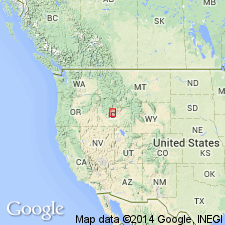
Named for exposures on north slope, Pole Creek Canyon at confluence with Grand Prize Creek, Horton Peak 7 1/2 min quad, Custer Co, ID in the Idaho Mountains province; these exposures also designated the type locality. Crops out over an area of 800 sq km, from 2 km north of Galena Summit north to Yankee Fork of Salmon River; was previously mapped as part of Wood River Formation. Divided into (ascending): unit 1, dark-gray carbonaceous prominently banded siltite which has a gray, sandy limestone at top; unit 2, bluish-gray, fine-grained, silty, fossiliferous limestone; unit 3, gray, banded, medium- to thick-bedded limy siltstone; and unit 4, a dark-gray banded siltite and gray to bluish-gray, cross-bedded, silty, fine-grained limestone. Is 1,450 m thick at type (top not exposed). Structurally overlies Wood River Formation or Salmon River assemblage. Structurally underlies Dollarhide Formation (new). Assigned an Early Permian, Leonardian age, but could be as old as Pennsylvanian or Early Permian, Wolfcampian. Has conodonts of the same age as Pequop Formation of NV, UT, Kaibab and Grandeur Formations of UT, NV, and Meade Peak Member, Phosphoria Formation of UT, NV and southern ID.
Source: GNU records (USGS DDS-6; Denver GNULEX).
- Usage in publication:
-
- Grand Prize Formation
- Modifications:
-
- Overview
- Reference
- Dominant lithology:
-
- Conglomerate
- Limestone
- Sandstone
- Siltstone
- AAPG geologic province:
-
- Idaho Mountains province
- Snake River basin
Summary:
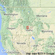
Generalized geologic map shows Grand Prize to occur from Galena Summit, Blaine Co, ID, Snake River basin, northward to north of Salmon River, Custer Co, ID, Idaho Mountains province. Supplemental composite reference section established at Fourth of July Creek, Custer Co, ID. Basal 500 m measured in Strawberry Basin north of Blackman Peak at 9800-10111 ft elevation; 500-2500 m interval measured on ridge north of Fourth of July Creek at 7800-9200 ft elevation; within Obsidian and Washington Peak quads. Upper portion of reference section is overturned. Grand Prize divided into four informal members: 1) basal conglomerate with overlying bioclastic limestone and graded sandstone, 2) massive structureless sandstone with minor siltstone laminae, 3) banded very fine-grained sandstone and siltstone with interbedded massive sandstone, and 4) dark, carbonaceous siltstone and mudstone with interbedded graded sandstone to siltstone sequences. Description of members and depositional mechanisms discussed in detail. Additional partial measured sections. Thickness of Grand Prize thought to exceed 2500 m. Uppermost member 4 may correlate with upper part of Dollarhide Formation. Low-angle fault separates Grand Prize from underlying Wood River Formation in southern part of study area and from Paleozoic Salmon River assemblage in northern part. Assigned Early Permian age.
Source: GNU records (USGS DDS-6; Denver GNULEX).
- Usage in publication:
-
- Grand Prize Formation*
- Modifications:
-
- Revised
- Reference
- Age modified
- Overview
- AAPG geologic province:
-
- Snake River basin
Summary:
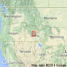
Newly assigned 1 of 3 formations of Sun Valley Group (new); these 3 are lateral variations of originally contiguous strata deposited in late Paleozoic Wood River basin. Grand Prize north part of basin. Exposed north of Pole Creek in White Cloud Peaks. Consists of 2,000+ m of fine-grained quartz arenite, limy siltstone, banded siltite, dark carbonaceous silty limestone. Reference section composite member 1 Strawberry basin, lat 44 deg 04' 28" N, long 114 deg 39' 32" N, 9800'-10,111' elevation, north of Blackman Peak, Blaine Co, ID, Snake River basin, and members 2, 3, 4 north of Fourth of July Creek, lat 44 deg 03' 18" N, long 114 deg 43' 48" W. Other reference section for members 2, 3, 4 on ridge south of Champion Lakes. Member 1 (Desmoinesian) 300-400 m thick polymict conglomerate and sandstone, and carbonaceous bioclastic limestone. Member 2 (Desmoinesian to Wolfcampian) 500+-1100 m thick-bedded to massive micritic sandstone, subordinate sandy micrite, micritic siltstone and mudstone. Member 3 (Wolfcampian to Leonardian?) 650-1200 m rhythmically interbedded couplets of gray, fine-grained, banded micritic sandstone interbedded with thick-bedded micritic sandstone and sandy micrite. Member 4 (Wolfcampian to Leonardian) 450+ m thin- to medium-bedded carbonaceous siltstone, sandy to silty micrite, mudstone and micritic sandstone. Stratigraphic charts and figures. Geologic map correlates with Wood River and Dollarhide Formations of Sun Valley Group.
Source: GNU records (USGS DDS-6; Denver GNULEX).
- Usage in publication:
-
- Grand Prize Formation*
- Modifications:
-
- Areal extent
- Overview
- AAPG geologic province:
-
- Idaho Mountains province
Summary:
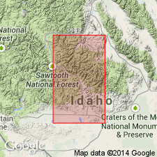
Lowermost part (member 1, Desmoinesian) mapped in area of Hoodoo mine, Custer Co, ID, Idaho Mountains province. Previously mapped as Hailey Conglomerate Member of Wood River Formation by Van Noy and others (1986, USGS Bulletin 1545, Chapter E, p. 262). Hailey Member and member 1 of Grand Prize are correlative units. Grand Prize, Wood River, and Dollarhide Formations are all of Sun Valley Group. Divided into four members. Basal contact of member 1 is an erosional unconformity with underlying Paleozoic Salmon River assemblage; older than Cretaceous intrusive rocks of the Idaho batholith. Geologic map; stratigraphic column, correlation chart; facies diagram. Assigned Middle Pennsylvanian to Early Permian age.
Source: GNU records (USGS DDS-6; Denver GNULEX).
For more information, please contact Nancy Stamm, Geologic Names Committee Secretary.
Asterisk (*) indicates published by U.S. Geological Survey authors.
"No current usage" (†) implies that a name has been abandoned or has fallen into disuse. Former usage and, if known, replacement name given in parentheses ( ).
Slash (/) indicates name conflicts with nomenclatural guidelines (CSN, 1933; ACSN, 1961, 1970; NACSN, 1983, 2005, 2021). May be explained within brackets ([ ]).