

- Usage in publication:
-
- Grand Mesa Formation*
- Modifications:
-
- Named
- Dominant lithology:
-
- Till
- Soil
- Gravel
- AAPG geologic province:
-
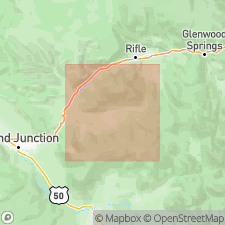
- Piceance basin
Summary:
Name applied to glacial, alluvial, and colluvial deposits on Grand Mesa. Includes two tills, three levels of terrace gravel, pediment gravel, mudflow deposits, and fan gravel. Type section measured in SW1/4 sec 3, T12S, R96W, Mesa Co, CO in Piceance basin. Consists of till (gray-brown, gravelly, unsorted silt loam) overlain by soil horizon B (yellowish-brown gravelly silt loam) and soil horizon A (brown to dark-brown gravelly silt loam) that total 6 ft thick, and are called the lower till member. The upper till member is present at Trickle Park Lake, el 10,000 ft. Upper till contains abundant green and red siltstone, sandstone, and fresh basalt cobbles and boulders, and ranges from 10 to 100 ft thick. Measured section 50.3 ft thick of fan gravel facies described in NW1/4 SW1/4 sec 34, T7S, R96W. Is younger than Lands End Formation (new). Is the youngest Pleistocene (Pinedale?) unit in report area.
Source: GNU records (USGS DDS-6; Denver GNULEX).
For more information, please contact Nancy Stamm, Geologic Names Committee Secretary.
Asterisk (*) indicates published by U.S. Geological Survey authors.
"No current usage" (†) implies that a name has been abandoned or has fallen into disuse. Former usage and, if known, replacement name given in parentheses ( ).
Slash (/) indicates name conflicts with nomenclatural guidelines (CSN, 1933; ACSN, 1961, 1970; NACSN, 1983, 2005, 2021). May be explained within brackets ([ ]).