- Usage in publication:
-
- Grand Falls chert
- Modifications:
-
- Original reference
- Dominant lithology:
-
- Chert
- AAPG geologic province:
-
- Ozark uplift
Summary:
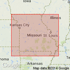
Pg. 417-419. Grand Falls chert. Very dense, hard chert, 30 feet thick in Shoal Creek section of southwestern Missouri. Occurs in massive layers 6 or more feet thick; has a gnarled and knotted structure, producing uneven surface. [Age is Mississippian (Keokuk).]
[Named from exposures at Grand Falls on Shoal Creek, just west of Joplin, in N/2 S/2 sec. 28, T. 27 N., R. 33 W., Joplin West 7.5-min quadrangle, Newton Co., MO.]
Source: US geologic names lexicon (USGS Bull. 896, p. 852); Missouri lexicon (Thompson, 2001, Missouri Geol. Survey Rpt. Inv., no. 73, p. 118-119).
- Usage in publication:
-
- Grand Falls chert member*
- Modifications:
-
- Principal reference
- Revised
- Dominant lithology:
-
- Chert
- AAPG geologic province:
-
- Ozark uplift
Summary:
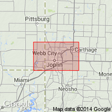
(Siebenthal.) Grand Falls chert member of Boone formation. Almost wholly heavy beds of solid chert, but is not persistent and in many areas its stratigraphic horizon is occupied by limestone. Its distinctive characters are heavy bedding, "live" splintery fracture, fine brecciation and cementation, and spotting. Thickness 15 to 120 feet. Lies about 100 feet below Short Creek oolite member of the Boone, and from 25 to 100 feet above base of Boone. Occurs in southwestern Missouri, southeastern Kansas, northwestern Arkansas, and northeastern Oklahoma. Fossils [listed] include species distinctly suggestive of Keokuk and none particularly suggestive of Burlington. Age is Mississippian (Keokuk).
Named from development around Grand Falls, Newton Co., southwestern MO.
Source: US geologic names lexicon (USGS Bull. 896, p. 852).
- Usage in publication:
-
- Grand Falls chert member
- Modifications:
-
- Revised
- AAPG geologic province:
-
- Chautauqua platform
- Cherokee basin
- Ozark uplift
Summary:
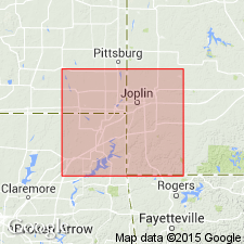
Pg. 3, 10. Grand Falls chert member of Keokuk limestone. Named subdivisions of Keokuk are Grand Falls chert, at base, and Short Creek oolite near top. Grand Falls is an irregularly bedded mass of dense "butcher knife" chert, mostly light gray but appears light yellowish brown or dark brown in weathered exposures. Thickness at type locality (including beds below water level) 35 feet. Locally discontinuous but identified over hundreds of sq mi in Tri-State district. Age is Early Mississippian (Osage).
Source: US geologic names lexicon (USGS Bull. 1200, p. 1563-1564).
- Usage in publication:
-
- Grand Falls chert
- Modifications:
-
- Revised
- AAPG geologic province:
-
- Ozark uplift
Branson, E.B., 1944, The geology of Missouri: University of Missouri Studies, v. 19, no. 3, 535 p.
Summary:
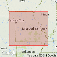
Pg. 197, 204. Report refers to Grand Falls chert at top of Reeds Spring member of Chouteau formation. Also refers to Reeds Spring limestone and quotes at length unpublished manuscript by Clark (1941) who classed the Grand Falls as member of Reeds Spring. [Age is Early Mississippian.]
Source: US geologic names lexicon (USGS Bull. 1200, p. 1563-1564).
- Usage in publication:
-
- Grand Falls formation
- Modifications:
-
- Revised
- AAPG geologic province:
-
- Chautauqua platform
- Cherokee basin
- Ozark uplift
Clark, E.L., and Beveridge, T.R., 1952, A revision of the Early Mississippian nomenclature in western Missouri: Missouri Division of Geological Survey and Water Resources Report of Investigations, no. 13, 93 p., See also Kansas Geol. Soc. Gdbk., 16th Regional Field Conf., 1952, p. 71-79
Summary:
Cites Kansas Geol. Soc. Gdbk, no. 16, p. 13 (fig. 1), 14-15 (fig. 2), 38 (fig. 12), 40 (fig. 15), 41 (fig. 16), 53 (fig. 26), 72 (fig. 1). Report refers to Grand Falls formation. Overlies Reeds Spring formation or Pierson formation; underlies Burlington formation or Keokuk formation. [Age is Early Mississippian.]
Source: US geologic names lexicon (USGS Bull. 1200, p. 1563-1564).
- Usage in publication:
-
- Grand Falls member
- Modifications:
-
- Overview
- AAPG geologic province:
-
- Chautauqua platform
- Cherokee basin
- Ozark uplift
Summary:
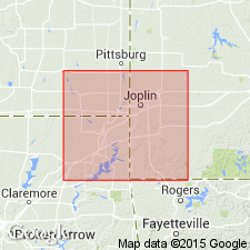
Pg. 517 (fig. 2). Chart shows Grand Falls member of Boone formation below Short Creek member and above Reeds Spring member. Thickness 6 to 38 feet. [Age is Early Mississippian.]
[Misprint (USGS Bull. 1200, p. 1564): Date of publication should be 1958, not 1959.]
Source: US geologic names lexicon (USGS Bull. 1200, p. 1563-1564).
- Usage in publication:
-
- Grand Falls Chert Member*
- Modifications:
-
- Age modified
- Contact revised
- AAPG geologic province:
-
- Chautauqua platform
- Cherokee basin
- Ozark uplift
Summary:
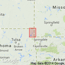
Pg. 13 (fig. 2), 20 (table 2), 27-32. Grand Falls Chert Member of Boone Formation. Recognized in Pilcher mining field area, Cherokee County, Kansas, Ottawa County, Oklahoma, and Newton County, Missouri. Varies from a hard, brittle "butcher knife" flint to a soft, porous cotton rock or tripoli. In places contains lenticular beds of brown fine-grained limestone. Thickness 25 to 95 feet. Overlies Reeds Spring Member and underlies Joplin Member, both of Boone Formation. Age is Early Mississippian (Osage), based on fossils (corals, bryozoans, brachiopods, mollusks, trilobites) [listed].
Type locality: a few mi southwest of Joplin, MO, and about 10 mi east of Baxter Springs, KS.
Source: Publication; Changes in stratigraphic nomenclature, 1970 (USGS Bull. 1354-A, p. A10-A11).
- Usage in publication:
-
- Grand Falls chert (informal)
- Modifications:
-
- Areal extent
- AAPG geologic province:
-
- Cherokee basin
Summary:
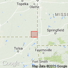
Grand Falls chert in upper part of Reeds Spring Limestone Member of Fern Glen Limestone. Gray to brown; breaks into distinctive sharp fragments and is known locally as "butcher-knife chert." Thickness about 45 feet (14 m). Age is Early Mississippian (Osagean).
Not recognized formally in Kansas, owing to its limited outcrop area, it is considered to be a separate formation in Missouri (Howe, 1961). The deposits of lead and zinc that have been mined throughout the Tri-State district (Missouri-Kansas-Oklahoma) occur primarily in the Grand Falls Chert and in the overlying rocks of Mississippian age.
Source: Publication.
For more information, please contact Nancy Stamm, Geologic Names Committee Secretary.
Asterisk (*) indicates published by U.S. Geological Survey authors.
"No current usage" (†) implies that a name has been abandoned or has fallen into disuse. Former usage and, if known, replacement name given in parentheses ( ).
Slash (/) indicates name conflicts with nomenclatural guidelines (CSN, 1933; ACSN, 1961, 1970; NACSN, 1983, 2005, 2021). May be explained within brackets ([ ]).

