

- Usage in publication:
-
- Grand Castle Formation*
- Modifications:
-
- Named
- Dominant lithology:
-
- Conglomerate
- Sandstone
- AAPG geologic province:
-
- Great Basin province
Summary:
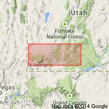
Named for topographic feature southeast of Parowan, eastern Iron Co, UT, Great Basin province. Composite type section (measured): base of lower and middle members on west side of Grand Castle, NE/4 sec 6, T35S, R8W; base of upper member on south side of Grand Castle, NW/4 NE/4 sec 8, T35S, R8W. Exposed on Markagunt Plateau from south of Cedar Breaks National Monument northward to Paragonah area and west of Parowan in Parowan Gap area. Generalized geologic map. Had been considered lower part of Claron Formation (revised). Divided into three informal members. Upper and lower conglomerate members consist of boulder- to pebble-size clasts grading upward into sandstone; fossil plant fragments and petrified wood occur in upper member. Middle sandstone member consists of very fine- to fine-grained sandstone; log casts, carbonized wood debris, leaf impressions, and root traces; rare burrows. Thickness at type is 181.4 m; ranges up to 230 m. Isopach map. Lower conglomerate member forms gray hoodoos. Unit provides a tectonostratigraphic record between Sevier and Laramide orogenies for southwest UT. Unconformably overlies Iron Springs Formation. Age is not well constrained; correlative rocks to east in Table Cliff Plateau are probably lower Paleocene based on early Paleocene palynomorphs in overlying and underlying rocks; late Paleocene palynomorphs in basal part of Claron to southwest in Pine Valley Mountains.
Source: GNU records (USGS DDS-6; Denver GNULEX).
For more information, please contact Nancy Stamm, Geologic Names Committee Secretary.
Asterisk (*) indicates published by U.S. Geological Survey authors.
"No current usage" (†) implies that a name has been abandoned or has fallen into disuse. Former usage and, if known, replacement name given in parentheses ( ).
Slash (/) indicates name conflicts with nomenclatural guidelines (CSN, 1933; ACSN, 1961, 1970; NACSN, 1983, 2005, 2021). May be explained within brackets ([ ]).