The National Geologic Map Database is migrating to a new infrastructure. We apologize for any service disruptions during this process.
|
|---|


- Usage in publication:
-
- Gosport greensand
- Modifications:
-
- Original reference
- Dominant lithology:
-
- Sand
- Glauconite
- AAPG geologic province:
-
- Mid-Gulf Coast basin
Summary:
Pg. 5, 18. Gosport greensand. Embraces the strata of Claiborne group lying between top of Lisbon formation and base of St. Stephens limestone. The beds are in general highly glauconitic sands about 30 feet thick at Claiborne and Gosport bluffs, and include the fossiliferous greensands that have made the name Claiborne famous, and which have furnished greater part of Claiborne fossils described and figured by Conrad and Lea.
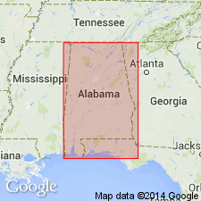
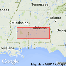
[Is top formation of Claiborne group in southern Alabama, and of marine origin. Age is middle Eocene. Named for Gosport, a landing on Alabama River, a few mi below Claiborne Bluff, in Clarke Co., southern AL.]
Source: US geologic names lexicon (USGS Bull. 896, p. 843).
- Usage in publication:
-
- Gosport sand†
- Modifications:
-
- Not used
- AAPG geologic province:
-
- Mid-Gulf Coast basin
Summary:
Pg. 337-340. Gosport sand of Alabama, heretofore classified as topmost formation of Claiborne group, and the only known formation of upper Claiborne age, is nearly equivalent to Moodys marl of Mississippi, basal formation of Jackson group. Recommended that name Gosport be replaced by Moodys and that Claiborne group be restricted to formations heretofore classified as lower Claiborne. [Age is middle Eocene.]
Source: US geologic names lexicon (USGS Bull. 1200, p. 1551).

- Usage in publication:
-
- Gosport sand
- Modifications:
-
- Revised
- AAPG geologic province:
-
- Mid-Gulf Coast basin
Summary:
Pg. 11. Gosport formation. Here considered to include overlying lithologically and faunally similar PORIACHUS bed or "SCUTELLA" bed which was formerly considered to be basal bed of Jackson group. Entire formation exposed at Claiborne Bluff where it is 24 to 26 feet thick; thickness 35 feet at Willow Branch in Choctaw County, southern Alabama. Disconformably overlies Lisbon formation; conformably underlies Moodys Branch marl. [Age is middle Eocene.]
Source: US geologic names lexicon (USGS Bull. 1200, p. 1551).
- Usage in publication:
-
- Gosport sand*
- Modifications:
-
- Areal extent
- AAPG geologic province:
-
- Mid-Gulf Coast basin
Summary:
Gosport sand. Correlation chart of outcropping Tertiary formations of eastern Gulf region shows Gosport sand, in Claiborne group, above Lisbon formation and present in Alabama and Georgia. Base of Gosport sand, which lies disconformably on different parts of Lisbon formation in central eastern Alabama, passes into upper part of Cockfield formation in Mississippi and becomes indistinct. Gosport pinches out just east of Ocmulgee River in central Georgia, but recurs filling channels in Cretaceous beds for some distance to the east. C.W. Cooke believes that Gosport at type locality is entirely of Jackson age, but that in general it represents a facies different faunally from Moodys Branch formation; he does not believe that name Gosport should be used in Georgia.
Source: US geologic names lexicon (USGS Bull. 1200, p. 1551).
- Usage in publication:
-
- Gosport Sand
- Modifications:
-
- Areal extent
- AAPG geologic province:
-
- Mid-Gulf Coast basin
Summary:
In Georgia, authors include the Gosport Sand with the Lisbon Formation because of lack of fossils to differentiate the two formations. They consider the Lisbon and Tallahatta Formations as the updip clastic facies of the middle Eocene in Georgia and correlate them with these formations in Alabama. They also correlate them with the downdip limestone equivalents, the Avon Park and Lake City Limestones, of peninsular Florida. Authors use the names Lisbon and Tallahatta throughout Georgia.
Source: GNU records (USGS DDS-6; Reston GNULEX).

- Usage in publication:
-
- Gosport Sand
- Modifications:
-
- Overview
- AAPG geologic province:
-
- Mid-Gulf Coast basin
Summary:
Pg. 45. Gosport Sand of Claiborne Group. Quartzose, calcareous, fine- to coarse-grained, glauconitic, very fossiliferous sand containing lenses of greenish-gray shale. Present in southwest Alabama. Thickness ranges from 17 to 30 feet. Unconformably underlies Moodys Branch Formation of Jackson Group and unconformably overlies Lisbon Formation of Claiborne. Age is middle Eocene (Bartonian).
See also L.D. Toulmin, 1977, Alabama Geol. Survey Mon., no. 13, p. 115-116.
Source: Publication.

- Usage in publication:
-
- Gosport Sand
- Modifications:
-
- Revised
- AAPG geologic province:
-
- Mid-Gulf Coast basin
Summary:
Various authors have placed the Gosport/Moodys Branch boundary at various places within the 25-foot greensand section exposed at Little Stave Creek, Jackson, Alabama. Toulmin (1962) divided the greensand into beds 41, 42, and 43 on the basis of faunal discontinuities and placed the boundary at the base of 42. Brady (1949) and Smith and others (1944) had placed the boundary at higher levels, Smith having included all of the greensands in the Gosport. In this report, bed 42 (approximately 3 feet thick) is included in the Gosport rather than the Moodys Branch. Bed 42 is concretionary as is underlying bed 41.
Source: GNU records (USGS DDS-6; Reston GNULEX).
- Usage in publication:
-
- Gosport Sand
- Modifications:
-
- Overview
- AAPG geologic province:
-
- Mid-Gulf Coast basin
Summary:
Gosport Sand. Recognized in downdip (south) area. Underlies and intertongues with Cockfield Formation; unconformably overlies Gordon Creek Shale Member of Cook Mountain Formation. All included in Claiborne Group. Age is middle Eocene (Bartonian); nannofossil zone NP17, planktic foram zone P14 (T. ROHRI zone).
Source: Publication.
For more information, please contact Nancy Stamm, Geologic Names Committee Secretary.
Asterisk (*) indicates published by U.S. Geological Survey authors.
"No current usage" (†) implies that a name has been abandoned or has fallen into disuse. Former usage and, if known, replacement name given in parentheses ( ).
Slash (/) indicates name conflicts with nomenclatural guidelines (CSN, 1933; ACSN, 1961, 1970; NACSN, 1983, 2005, 2021). May be explained within brackets ([ ]).