The National Geologic Map Database is migrating to a new infrastructure. We apologize for any service disruptions during this process.
|
|---|


- Usage in publication:
-
- Goshute Canyon formation
- Modifications:
-
- Named
- Dominant lithology:
-
- Quartzite
- Shale
- AAPG geologic province:
-
- Great Basin province
Summary:
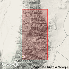
Name applied to the lower 3,000 ft of a 6,000 ft thick sequence formerly assigned to the Prospect Mountain quartzite. Unconformably overlies Precambrian metamorphic rocks. Underlies a restricted prospect Mountain that consists of 3,000 ft of quartzite. Can be divided into 4 members at its measured type section in NE1/4 sec 1, T11S, R18W to SW1/4 sec 36, T10S, R18W, Juab Co, UT in the Great Basin province. Member A, at the base, is gray, medium grained 500 ft thick quartzite. The overlying member B consists of interbedded gray shale and gray quartzite. Member C is a gray medium grained, thick bedded quartzite 734 ft thick. Member D, at the top, is 265 ft thick; it consists of a basal conglomerate of quartzite pebbles in a gray shale matrix, gray to purple sandy shale, and purple shaly sandstone at top. Age is unknown. Assigned to the Precambrian or Cambrian or both.
Source: GNU records (USGS DDS-6; Denver GNULEX).
- Usage in publication:
-
- Goshute Canyon Formation
- Modifications:
-
- Overview
- AAPG geologic province:
-
- Great Basin province
Summary:
Mapped (geologic map) in southwest part of report area, Juab Co., UT, and in north part of report area, Tooele Co, UT in the Great Basin province. Best exposures are along the east base of Deep Creek Mountains from Hardscrabble Canyon to Middle Canyon. Overlies the informally named "formation D" of Precambrian and Cambrian age. Underlies the stratigraphically restricted Lower Cambrian Prospect Ma Quartzite. The Prospect Mountain of pre-Bick (1959)included the Goshute Canyon of this report. Divisible into two quartzite members -member a 200 ft thick and member d 265 ft thick, and two shale and shaly sandstone members --member b 1,506 ft thick and, member d 265 ft thick in Goshute Canyon where a section was measured. Thought to be 3,200 ft thick. Assigned a Precambrian and/or Cambrian age. Resembles Mutual Formation and parts of McCoy Creek Group.
Source: GNU records (USGS DDS-6; Denver GNULEX).
For more information, please contact Nancy Stamm, Geologic Names Committee Secretary.
Asterisk (*) indicates published by U.S. Geological Survey authors.
"No current usage" (†) implies that a name has been abandoned or has fallen into disuse. Former usage and, if known, replacement name given in parentheses ( ).
Slash (/) indicates name conflicts with nomenclatural guidelines (CSN, 1933; ACSN, 1961, 1970; NACSN, 1983, 2005, 2021). May be explained within brackets ([ ]).