

- Usage in publication:
-
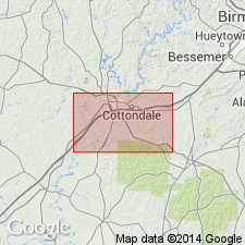
- Gordo formation*
- Modifications:
-
- Named
- Dominant lithology:
-
- Gravel
- Sand
- Clay
- AAPG geologic province:
-
- Warrior basin
Summary:
Gordo formation provisionally defined as the interbedded series of nonmarine gravel, sand, and clay beds between the horizon [top of Coker formation] at which gravel first appears consistently and abundantly and the base of the McShan formation (new). Base of unit is marked by abrupt appearance of abundant chert gravel and gravelly sand, the gravel gradually decreasing in abundance upward. Consists of two unnamed members: the lower--130 ft of gravel and sand, and the upper--60 to 100 ft of clay and nongravelly sand.
Source: GNU records (USGS DDS-6; Reston GNULEX).
- Usage in publication:
-
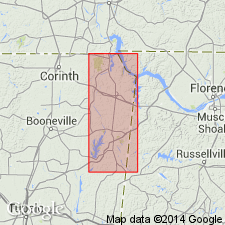
- Gordo formation*
- Modifications:
-
- Principal reference
- AAPG geologic province:
-
- Black Warrior basin
Summary:
Type section of Gordo formation is designated little Bear Valley, Pickens Co., AL. Exposure is middle third of formation showing typical gravelly sand and mottled clay. Thickness is 92 ft. Geographically extended into Tishomingo Co., MS, where it is overlapped by Eutaw formation.
Source: GNU records (USGS DDS-6; Reston GNULEX).
- Usage in publication:
-
- Gordo Formation*
- Modifications:
-
- Age modified
- AAPG geologic province:
-
- Black Warrior basin
Summary:
Gordo Formation of Tuscaloosa Group is of possible late Turonian age.
Source: GNU records (USGS DDS-6; Reston GNULEX).
- Usage in publication:
-
- Gordo Formation
- Modifications:
-
- Overview
- AAPG geologic province:
-
- Black Warrior basin
Summary:
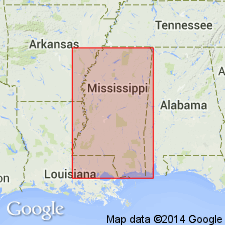
Gordo Formation is the only representative of Tuscaloosa Group in Tishomingo Co., northeastern MS. Underlies the McShan Formation of Eutaw Group.
Source: GNU records (USGS DDS-6; Reston GNULEX).
- Usage in publication:
-
- Gordo Formation
- Modifications:
-
- Overview
- AAPG geologic province:
-
- Black Warrior basin
Summary:
Gravels mapped as Tuscaloosa in Tishomingo Co., MS, and northwestern AL are actually two distinct lithic units of different age. Lower gravels are chert gravel in a quartz sand matrix that can be traced southeast into the Gordo Formation. Upper chert gravel, with rare lenses of chert sand and kaolinitic clay unconformably overlies the lower unit and is best developed to the north in Tishomingo Co. This upper gravel is probably equivalent to the McShan Formation.
Source: GNU records (USGS DDS-6; Reston GNULEX).
For more information, please contact Nancy Stamm, Geologic Names Committee Secretary.
Asterisk (*) indicates published by U.S. Geological Survey authors.
"No current usage" (†) implies that a name has been abandoned or has fallen into disuse. Former usage and, if known, replacement name given in parentheses ( ).
Slash (/) indicates name conflicts with nomenclatural guidelines (CSN, 1933; ACSN, 1961, 1970; NACSN, 1983, 2005, 2021). May be explained within brackets ([ ]).