The National Geologic Map Database is migrating to a new infrastructure. We apologize for any service disruptions during this process.
|
|---|


- Usage in publication:
-
- Gooseberry Member*
- Modifications:
-
- Named
- Dominant lithology:
-
- Ash
- Limestone
- Conglomerate
- AAPG geologic province:
-
- Green River basin
Summary:
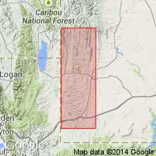
Named as upper member of Fowkes Formation for exposures near Gooseberry Springs, west-central part of Sage quad, Lincoln Co, WY in Greater Green River basin. Type area is a conglomerate ledge exposure 2 mi northeast of Sage. Type section measured and described in N1/2 sec 33, T22N, R119W. Is confined to area northeast of Sage that was mapped as Almy Formation by Veatch (1907). Is about 150 ft thick at type. May be as much as 200 ft thick. Consists of light-gray to white puddingstone [conglomerate], calcareous rhyolitic ash, and tuff and ash-bearing, very finely crystalline to subaphanitic limestone. The puddingstone consists of sparsely to moderately tightly packed cobbles and pebbles (mostly quartzite, chert, limestone) in a matrix of white to pale buff, silty and tuffaceous, highly calcareous sandstone, marlstone, and sandy limestone. Most clasts 6 in or less in diameter. Packing is so poor that some cobbles in contact with each other. Gradational contact with underlying Bulldog Hollow Member (new) of Fowkes. [Upper contact not described.] Assigned an Eocene? or Pliocene? age. Assignment to Fowkes provisional. Possibility of assignment to Salt Lake Formation discussed. Stratigraphic chart.
Source: GNU records (USGS DDS-6; Denver GNULEX).
- Usage in publication:
-
- Gooseberry Member*
- Modifications:
-
- Overview
- AAPG geologic province:
-
- Green River basin
Summary:
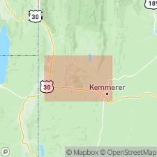
Is the upper member (of 3) included tentatively in Fowkes Formation. Is mapped (geologic map, cross sections) north of Twin Creek to north map boundary at west side of map, Lincoln Co, WY, Greater Green River basin, where it is underlain by Bulldog Member of Fowkes. Younger adjacent units are Quaternary in age. This indurated puddingstone and conglomerate has well rounded pebbles of Paleozoic quartzite, chert, limestone, and volcanic rocks (rhyolite to vesicular basalt) cemented by white, sandy to silty, tuffaceous limestone. Packing of clasts varies from poor (puddingstone) to good (conglomerate). Granule or pebble lenses. Clasts mostly 6 inches in diameter. May be as much as 200 ft thick. No stratigraphic top is known. No fossils found. Is similar to underlying Bulldog Hollow and may be Eocene. Identical to rocks on Bear Lake Plateau 20 mi to east that have fossil teeth of Miocene or Pliocene age. May be an isolated remnant of Salt Lake Formation. Shown on geologic map as Pliocene? or Eocene?.
Source: GNU records (USGS DDS-6; Denver GNULEX).
For more information, please contact Nancy Stamm, Geologic Names Committee Secretary.
Asterisk (*) indicates published by U.S. Geological Survey authors.
"No current usage" (†) implies that a name has been abandoned or has fallen into disuse. Former usage and, if known, replacement name given in parentheses ( ).
Slash (/) indicates name conflicts with nomenclatural guidelines (CSN, 1933; ACSN, 1961, 1970; NACSN, 1983, 2005, 2021). May be explained within brackets ([ ]).