

- Usage in publication:
-
- Goose Lake Member*
- Modifications:
-
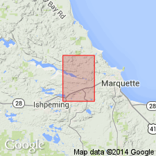
- Areal extent
- AAPG geologic province:
-
- Lake Superior region
Summary:
Is a member within the Siamo Slate (middle Precambrian) of the Menominee Group of the Marquette Range Supergroup. Is thought to be present within the Siamo as mapped in the Negaunee quadrangle (pl. 1), Marquette Co, MI (Lake Superior region). "A narrow linear magnetic anomaly was traced from the edge of the quadrangle in sec 36, T48N, R26W, northwest to near the center of sec 34, T48N, R26W (pl. 1). There are no outcrops of the magnetic bed, but its position within the Siamo Slate suggests that it is the Goose Lake Member (Tyler and Twenhofel, 1952, p. 118-125). The average width of the magnetic ridge is 200-250 feet. The total relief, at right angles to the trend of the anomaly, is 500-800 gammas. A narrow east-trending magnetic zone with relief of 350 gammas passing under Teal Lake in sec 36, T48N, R27W, is in the correct position to be the Goose Lake Member." Is not mapped on geologic map and anomalies appear to be "too low in magnetic relief or too limited in extent to be indicated on the aeromagnetic map."
Source: GNU records (USGS DDS-6; Reston GNULEX).
For more information, please contact Nancy Stamm, Geologic Names Committee Secretary.
Asterisk (*) indicates published by U.S. Geological Survey authors.
"No current usage" (†) implies that a name has been abandoned or has fallen into disuse. Former usage and, if known, replacement name given in parentheses ( ).
Slash (/) indicates name conflicts with nomenclatural guidelines (CSN, 1933; ACSN, 1961, 1970; NACSN, 1983, 2005, 2021). May be explained within brackets ([ ]).