The National Geologic Map Database is migrating to a new infrastructure. We apologize for any service disruptions during this process.
|
|---|


- Usage in publication:
-
- Gomez Tuff
- Modifications:
-
- Areal extent
- Geochronologic dating
- AAPG geologic province:
-
- Permian basin
Summary:
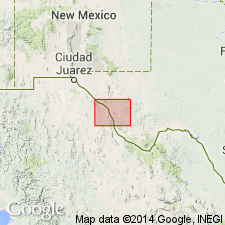
Gomez Tuff mapped in the Davis Mountains area, Jeff Davis County, West Texas, in Permian basin. Is peralkaline ash-flow tuff, densely welded to friable, one cooling unit; contains 1.5 mm phenocrysts of anorthoclase and some quartz, and microphenocrysts of aegirinaugite and some fayalite; abundant xenoliths of mafic lava, limestone, sandstone, biotite schist, and other rock types; gray, brown, green, and reddish-brown to black devitrified glass. Thickness to as much as 1,200 feet. K-Ar age of 36.6 +/-0.7 m.y. obtained (6 samples). [Unclear on "Correlation of Map Units" if Gomez is part of Vieja Group.] Occurs above Huelster Formation and below Adobe Canyon Formation (first used). [Author states that correlation of volcanic rocks from area to area on Marfa sheet is uncertain; little attempt is made to correlate between areas. The rocks are described by area.] Age is Oligocene.
Source: Modified from GNU records (USGS DDS-6; Denver GNULEX).
- Usage in publication:
-
- Gomez Tuff
- Modifications:
-
- Geochronologic dating
- AAPG geologic province:
-
- Permian basin
Summary:
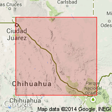
Pg. 13. Gomez Tuff. Erupted from Buckhorn caldera, northeastern Davis Mountains, Jeff Davis County, southwestern Texas. Peralkaline rhyolite samples, from Jeff Davis County, yielded K-Ar ages from 38.7 +/-0.8 Ma to 36.4 +/-0.8 Ma (alkali feldspar). Data from D.F. Parker, 1983 (GSA Bull., v. 94, p. 614-629), and D.F. Parker and F.W. McDowell, 1979 (GSA Bull., v. 90, p. 1100-1110); ages recalculated using decay constants of Steiger and Jager, 1977 (Earth Planet. Sci. Letters, v. 36, p. 359-362).
[Age considered Eocene to Oligocene; Eocene-Oligocene boundary 36.6 (38-34) Ma (from Geologic Names Committee, USGS, 1983 ed. geol. time scale, with additions from N.J. Snelling, 1985, The Geol. Soc. Mem., no. 10).]
Source: Publication.
- Usage in publication:
-
- Gomez Tuff
- Modifications:
-
- Overview
- Revised
- AAPG geologic province:
-
- Permian basin
Summary:
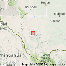
Type locality designated at Gomez Peak, northern Davis Mountains, Jeff Davis County, Texas, in the Permian basin. Overlies the Huelster or the Star Mountain Formation, or the Agua Grand Tuff. Overlain by Fox Canyon Formation (new) or Adobe Canyon Formation, in the northern Davis Mountains, and the Frazier Canyon Formation in the eastern Davis Mountains. Is 430 m thick at its type, but is 10 to 20 m thick tuff sheet over much of its outcrop area. The thickest section, about 450 m, is 2.7 m south-southwest of Gomez Peak. The tuff is usually densely welded, devitrified, characterized by abundant phenocrysts of anorthoclase, minor quartz set in an aphanitic groundmass that may show ghose shard texture, or may be granophyrically recrystallized. Vitrophyric zones occur at base of the densely welded devitrified zones locally. Densely welded zone forms steep columnar-jointed cliffs. Top is flat and forms bench. Flow banding, folding, and ramp structures common. Age is Tertiary. Report includes geologic map.
Source: Modified from GNU records (USGS DDS-6; Denver GNULEX).
For more information, please contact Nancy Stamm, Geologic Names Committee Secretary.
Asterisk (*) indicates published by U.S. Geological Survey authors.
"No current usage" (†) implies that a name has been abandoned or has fallen into disuse. Former usage and, if known, replacement name given in parentheses ( ).
Slash (/) indicates name conflicts with nomenclatural guidelines (CSN, 1933; ACSN, 1961, 1970; NACSN, 1983, 2005, 2021). May be explained within brackets ([ ]).