- Usage in publication:
-
- Goliad Formation
- Modifications:
-
- Mapped 1:250k
- Dominant lithology:
-
- Clay
- Sand
- Sandstone
- Marl
- Caliche
- Conglomerate
- AAPG geologic province:
-
- Gulf Coast basin
Summary:
Goliad Formation. Clay, sand, sandstone, marl, caliche, and conglomerate; clay, commonly light shades of pink or green, calcareous concretions; sand and sandstone, medium- to very coarse-grained, locally well bedded, in part cross-bedded, light gray, mostly quartz, some black and red chert; marl and caliche poorly bedded to massive; conglomerate, black chert and dark siliceous granules and pebbles mostly at base. Thickness about 100 feet. Overlies Fleming Formation (Miocene); underlies Willis Formation (Pleistocene). Tertiary vertebrate and reworked Cretaceous invertebrate fossils fairly common. Age is Pliocene.
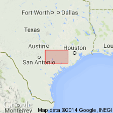
Mapped in De Witt and Lavaca Cos., southeastern TX. Is not mapped north beyond the Lavaca-Colorado Co. line.
Source: Modified from GNU records (USGS DDS-6; Denver GNULEX).

- Usage in publication:
-
- Goliad Formation
- Modifications:
-
- Mapped 1:250k
- Dominant lithology:
-
- Clay
- Sandstone
- Conglomerate
- Caliche
- Marl
- Limestone
- AAPG geologic province:
-
- Gulf Coast basin
Summary:
Goliad Formation. Clay, sandstone, marl, caliche, limestone, and conglomerate; clay, commonly light shades of pink or green, calcareous concretions; sand and sandstone, medium- to very coarse-grained, in part cross-bedded, mostly quartz, some black and red chert; conglomerate, black chert and dark siliceous granules and pebbles in calcareous ("caliche") matrix; sandstone and conglomerate locally well bedded; marl and limestone poorly bedded or massive; Tertiary vertebrate and reworked Cretaceous invertebrate fossils fairly common. Thickness up to 500 feet. [Overlies Fleming Formation (Miocene); underlies Lissie Formation (Pleistocene) and younger Quaternary fluviatile terrace deposits, windblown deposits, and alluvium.] Age is Pliocene.
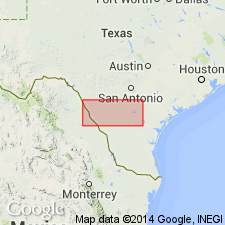
[Mapped in Duval, Jim Wells, McMullen, Live Oak, and Bee Cos., southern TX.]
Source: Publication.
For more information, please contact Nancy Stamm, Geologic Names Committee Secretary.
Asterisk (*) indicates published by U.S. Geological Survey authors.
"No current usage" (†) implies that a name has been abandoned or has fallen into disuse. Former usage and, if known, replacement name given in parentheses ( ).
Slash (/) indicates name conflicts with nomenclatural guidelines (CSN, 1933; ACSN, 1961, 1970; NACSN, 1983, 2005, 2021). May be explained within brackets ([ ]).

