

- Usage in publication:
-
- Golden's Ranch formation
- Modifications:
-
- Original reference
- Dominant lithology:
-
- Tuff
- Bentonite
- Conglomerate
- Limestone
- AAPG geologic province:
-
- Great Basin province
Muessig, S., 1951, Eocene volcanism in central Utah: Science, v. 114, no. 2957, p. 234.
Summary:
Pg. 234. Golden's Ranch formation. Series of tuffs, bentonites, and volcanic boulder conglomerates; includes Sage Valley [limestone] member (new) 820 feet above base. Conformably overlies unnamed unit (bentonitic tuffs intercalated with limestone) of Green River limestone. Volcanic conglomerate grade laterally into volcanic breccias that are part of latite series in northern part of area and in Tintic district. Age of Sage Valley is late middle or early late Eocene. Age of Golden's Ranch is implied to be Eocene. Originally defined in unpub. thesis (Muessig, 1951).
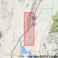
Type locality not designated. Origin of name not stated. Well exposed in roadcuts along U.S. Highway 91, in Long Ridge area, [about 7 mi] southwest of Levan, Juab Co., UT.
Source: US geologic names lexicon (USGS Bull. 1200, p. 1538); supplemental information from GNU records (USGS DDS-6; Denver GNULEX).
- Usage in publication:
-
- Goldens Ranch Formation
- Modifications:
-
- Revised
- AAPG geologic province:
-
- Great Basin province
Summary:
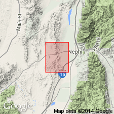
Divided into: Chicken Creek Tuff Member at base (new stratigraphic assignment), Hall Canyon Conglomerate Member (new name), and Sage Valley Limestone Member in the Nephi NW quad, Juab Co, UT in the Great Basin province. Type section designated [but not specifically described] in NW1/4 sec 18, T14S, R2W, Juab Co. [Upper contact probably modified from one chosen by Muessig in that Sage Valley Limestone Member used as top of Goldens Ranch.] Unconformably overlies Orme Spring Conglomerate (new). Unconformably underlies Fernow Quartz Latite. Of Oligocene age. Correlation chart.
Source: GNU records (USGS DDS-6; Denver GNULEX).
- Usage in publication:
-
- Goldens Ranch Formation*
- Modifications:
-
- Revised
- Geochronologic dating
- Areal extent
- AAPG geologic province:
-
- Great Basin province
- Wasatch uplift
Summary:
Used west of north-trending lowland formed by Juab-Sevier valleys, Sanpete County (Wasatch uplift) and Juab County (Great Basin province), Utah. Revised from Meibos (1983) to include not only a lower unit of lenticular ash-flow tuffs (his Chicken Creek Tuff Member), stream-deposited sediments (his Hall Canyon Conglomerate Member), Sage Valley Limestone Member (his upper member of Goldens Ranch), but also a younger unit of ash-flow and welded tuffs agglomerates, and volcanic breccia (his Fernow and Packard Quartz Latites, Copperopolis Latite, Cazier Canyon Conglomerate). Its correlative east of lowland is Moroni Formation. Contacts used for Goldens Ranch in this report thought to be same as those used by Muessig (1951). Thickness not known. Partial section 285 m ft thick present in Sage Valley. Is folded and faulted indicating structural deformation after emplacement. Clasts in formation derived from East Tintic Mountains include red-gray andesite and purple quartzite from Mutual Formation, tan quartzite from Tintic Quartzite, blue Paleozoic limestone. K-Ar ages (listed) of 39 Ma near base and 35 Ma near top from plagioclase, sanidine, biotite. Assigned to late Eocene to middle Oligocene. Correlation chart.
Source: GNU records (USGS DDS-6; Denver GNULEX).
For more information, please contact Nancy Stamm, Geologic Names Committee Secretary.
Asterisk (*) indicates published by U.S. Geological Survey authors.
"No current usage" (†) implies that a name has been abandoned or has fallen into disuse. Former usage and, if known, replacement name given in parentheses ( ).
Slash (/) indicates name conflicts with nomenclatural guidelines (CSN, 1933; ACSN, 1961, 1970; NACSN, 1983, 2005, 2021). May be explained within brackets ([ ]).