

- Usage in publication:
-
- Golden Valley formation
- Modifications:
-
- Original reference
- Dominant lithology:
-
- Sandstone
- Claystone
- Shale
- AAPG geologic province:
-
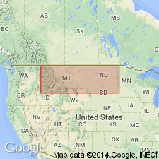
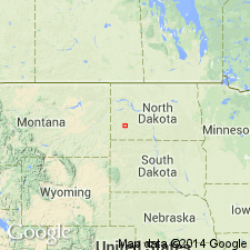
- Williston basin
Summary:
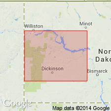
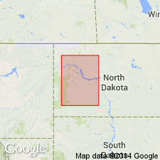
Golden Valley formation. Consists of fine-grained micaceous [sandstones] with minor amounts of light-colored [claystones] and shales; these [sandstones] and shales overlie a basal sequence of hard white to dark-gray [claystones], and locally, lignites; middle part of basal sequence is characteristically mottled reddish yellow on weathered surfaces and forms good marker bed. Formation includes beds bearing Eocene fossil fern SALVINIA PREAURICULATA. Unit has been referred to as unnamed formation of Wasatch group. Overlies [Paleocene] Sentinel Butte shale member of Fort Union; unconformably underlies Oligocene White River group. Recognized in Mercer, Dunn, McKenzie, and Stark Counties, North Dakota.
Type exposure: near town of Golden Valley, Mercer Co., ND.
Source: US geologic names lexicon (USGS Bull. 1200, p. 1538).
- Usage in publication:
-
- Golden Valley Formation
- Modifications:
-
- Revised
- AAPG geologic province:
-
- Williston basin
Summary:
Conformably overlies Tongue River member of Fort Union formation.
Source: US geologic names lexicon (USGS Bull. 1200, p. 1538).
- Usage in publication:
-
- Golden Valley formation*
- Modifications:
-
- Mapped 1:63k
- Dominant lithology:
-
- Shale
- Coal
- Sandstone
- AAPG geologic province:
-
- Williston basin
Summary:
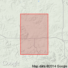
Golden Valley formation. Mapped in western part of Square Buttes district, southwest of Hannover, Oliver County, North Dakota (Williston basin), as several small isolated exposures. Only the lowermost 70 feet present in area. Consists of olive-gray silty shale, grayish-brown carbonaceous shale, thin coal beds, yellowish-gray to red-brown, fine- to coarse-grained sandstone. Has a conspicuous bed of orange-weathering shale about 6 feet above base. Is younger than Fort Union formation; older than glacial till. Age is Eocene.
Source: Modified from GNU records (USGS DDS-6; Denver GNULEX).
- Usage in publication:
-
- Golden Valley Formation
- Modifications:
-
- Revised
- AAPG geologic province:
-
- Williston basin
Summary:
Overlies Sentinel Butte shale herein considered member of Tongue River formation.
Source: US geologic names lexicon (USGS Bull. 1200, p. 1538).
- Usage in publication:
-
- Golden Valley Formation
- Modifications:
-
- Revised
- AAPG geologic province:
-
- Williston basin
Summary:
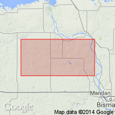
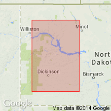
Pg. 5-23. In area of Mountrail County, [North Dakota], includes White Earth, South Ross, Lakeside, and East Tioga clay beds.
Source: US geologic names lexicon (USGS Bull. 1200, p. 1538).
- Usage in publication:
-
- Golden Valley Formation
- Modifications:
-
- Overview
- AAPG geologic province:
-
- Williston basin
Summary:
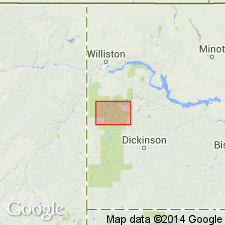
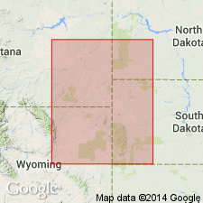
Two localities studied in Stark County, North Dakota (Williston basin). Fossil vertebrates of early Eocene (Sparnacian, Wasatchian age) found in association with fossil flora. The vertebrates (listed) are from 5 classes: AMPHIBIA, AVES, REPTILIA, MAMMALIA, and TELEOSTOMI. Most of the vertebrates found 2 to 5 inches below a distinctive highly indurated brittle layer of chert. The layer is 3 to 5 inches thick and it is very resistant to weathering. Some have referred to this layer as the HS layer (hard siliceous layer). Fossil flora (listed), especially leaf impressions, found in upper member of Golden Valley Formation are indicative of Wilcox age. Coprolites weather out abundantly. The riparian and aquatic animals and plants indicate a warm, humid, swampy lowland with subtropical forests bordering sluggish streams. Report includes distribution map.
Source: Modified from GNU records (USGS DDS-6; Denver GNULEX).
- Usage in publication:
-
- Golden Valley Formation
- Modifications:
-
- Revised
- AAPG geologic province:
-
- Williston basin
Summary:
In the Williston basin, the Golden Valley Formation covers an area of 13,000 sq. mi. Divided into a lower member of Paleocene age and an upper member of Eocene age. Lower member is characterized by the clay mineral kaolinite and by its tripartite color zonation from gray (at base) to orange to dark-gray (at top). Thickness not consistent; ranges from 0 to 65 feet, averaging 25 feet. Most beds in the lower member are only of local extent. Upper contact marked by the Alamo Bluff lignite or its equivalent, Taylor bed (new), a resistant siliceous siltstone or marlstone. Upper member is easily recognized; consists of channel and an interchannel facies. Is predominantly a soft, yellow to tan, gray to yellow-orange weathering claystone, siltstone, and sandstone, with some conglomerate. Contains montmorillonitic or illitic clay, and large mica flakes. Lacks stratigraphic markers. Upper part of upper member is leached and oxidized to depth of 25 to 100 feet [total thickness of upper member not stated]; this weathering took place prior to deposition of the unconformably overlying White River Group. Total preserved thickness of the Golden Valley Formation is 180 feet. Was deposited in a broad, shallow, gradually subsiding tectonic basin; is eroded from many areas. Overlies Sentinel Butte Member of Fort Union Formation. At most localities, this contact is conformable or gradational. At two localities, channels made by the upper member of Golden Valley cut down as deep into the lower or Tongue River Member of the Fort Union. Fossil plants common in lower two-thirds of formation. Lower member contains late Paleocene flora and mollusks (all listed). Upper member contains new floral megaspecies (listed) of Eocene age. Report includes cross sections.
Source: Modified from GNU records (USGS DDS-6; Denver GNULEX).
- Usage in publication:
-
- Golden Valley Formation*
- Modifications:
-
- Biostratigraphic dating
- AAPG geologic province:
-
- Williston basin
Summary:
Golden Valley Formation. Palynomorphs, collected from the Paleocene-Eocene boundary in the Golden Valley Formation of the Williston basin, are correlated with pollen zones of the Powder River basin. In the Williston basin, Hickey's (1972) Paleocene-Eocene boundary is defined on leaf floras, mollusks, and vertebrate fossils. Samples, from the Golden Valley Formation in Dunn and Mercer Counties, North Dakota (Williston basin), taken from below and above the Paleocene-Eocene boundary yielded palynomorphs characteristic of pollen zones defined in the Powder River basin. A sample from 20 feet below the boundary yielded a zone Y pollen assemblage, similar to that recovered from the lower part of the Wasatch Formation (below the Felix coal) in the Powder River basin. Two samples collected from above the boundary yielded PLATYCARYA pollen, characteristic of the zone Z pollen assemblage of the Felix coal and younger Wasatch rocks; PLATYCARYA was not found below the boundary.
Source: Modified from GNU records (USGS DDS-6; Denver GNULEX).
- Usage in publication:
-
- Golden Valley Formation
- Modifications:
-
- Revised
- Reference
- AAPG geologic province:
-
- Williston basin
Summary:
Golden Valley Formation. Strata formerly assigned to the lower member of the Golden Valley Formation are here named Bear Den Member; those formerly assigned to the upper member are here named Camels Butte Member. Bear Den Member deposited in a broad, swampy, fluvial lowland that has aggrading sluggish streams. Camels Butte Member deposited in a low fluvial region. Deep cutting by some channels during Camels Butte time suggests start of uplift. In the Williston basin, the Golden Valley has a maximum thickness of 55 km and covers 2,183 km area. At reference section, here designated, base [of formation] is covered and top is eroded; Bear Den Member is 7 m thick and Camels Butte Member is 36+ m thick. Five criteria cited for recognition of Golden Valley rocks: (1) kaolinitic composition of Bear Den Member and its color zones; (2) the gray, yellow, and orange zones of Bear Den contrast with the yellow, olive, brown, and dark-gray of the underlying Fort Union Formation; (3) scarcity of lignite, a contrast to the abundance of lignite in the Fort Union and its absence in the White River Group; (4) high mica content, particularly in Camels Butte; and (5) presence of the distinctive fern SALVINIA PREAURICULATA in Camels Butte. Golden Valley Formation overlies Sentinel Butte Member of Fort Union Formation; unconformably underlies White River Group. Bear Den Member contains a standard late Paleocene flora. Camels Butte Member contains vertebrate, invertebrate. and plant fossils indicative of the early Wasatchian. Report includes measured sections, cross sections, nomenclature chart, geologic map, list of fossils.
Reference section: south of town of Golden Valley, in W/2 NE/4 sec. 2, T. 143 N., R. 90 W., in Mercer Co., ND.
Source: Modified from GNU records (USGS DDS-6; Denver GNULEX).
For more information, please contact Nancy Stamm, Geologic Names Committee Secretary.
Asterisk (*) indicates published by U.S. Geological Survey authors.
"No current usage" (†) implies that a name has been abandoned or has fallen into disuse. Former usage and, if known, replacement name given in parentheses ( ).
Slash (/) indicates name conflicts with nomenclatural guidelines (CSN, 1933; ACSN, 1961, 1970; NACSN, 1983, 2005, 2021). May be explained within brackets ([ ]).