The National Geologic Map Database is migrating to a new infrastructure. We apologize for any service disruptions during this process.
|
|---|


- Usage in publication:
-
- Gold Range Formation
- Modifications:
-
- Named
- Dominant lithology:
-
- Shale
- Siltstone
- Tuff
- Ignimbrite
- Andesite
- AAPG geologic province:
-
- Great Basin province
Summary:
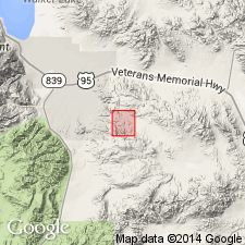
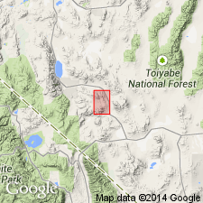
Unit described in thesis by Nielsen (1963) from exposures in Pilot Mountains, Excelsior Mountains, and eastern Garfield Hills, Mineral Co, NV, designated type area. Authors apply name Gold Range Formation to limestone, slate, and conglomerate units of Luning Formation as mapped by Ferguson and Muller (1949) in Pamlico district. Consists of purple shale and siltstone composed of water-lain volcanic material, andesitic agglomerate, pale gray green cherty tuff, lithic pebble conglomerate, rhyolitic ignimbrites, and andesite flows. Thickness estimate is 1000 ft. Unconformably overlies Excelsior(?) Formation (Permian). Conformably underlies and interfingers with Luning Formation (of Late Triassic age). Apparently unconformably underlies Dunlap(?) Formation of Early Jurassic age. Age given as Triassic on geologic map of Pamlico mining district.
Source: GNU records (USGS DDS-6; Menlo GNULEX).
- Usage in publication:
-
- Gold Range Formation
- Modifications:
-
- Revised
- Age modified
- AAPG geologic province:
-
- Great Basin province
Summary:
Type area designated in Gold Range mining district. Usage of name, Gold Range Formation, applies to thicker section of rocks and includes more of Excelsior Formation in eastern Excelsior Mountains than Nielsen (1963), connotes different time bounds, and excludes rocks assigned to Gold Range Formation in western Excelsior Mountains and at Black Dyke Mountain, now reassigned to Black Dyke Formation (new). Geologic sketch map shows Gold Range Formation in Gold Range District and in Pilot Mountains. Unconformably overlies Mina Formation (new). Unconformably underlies Tertiary andesite. Age is Triassic to probable Early Jurassic(?) based on stratigraphic relations and presence of flat clams (WEYLA sp.) in uppermost beds in Pilot Mountains.
Source: GNU records (USGS DDS-6; Menlo GNULEX).
- Usage in publication:
-
- Gold Range Formation
- Modifications:
-
- Areal extent
- AAPG geologic province:
-
- Great Basin province
Summary:
Gold Range Formation (Nielsen, 1963; Speed, 1977) is excluded from Pilot Mountains, NV. Rocks are informally termed, Triassic(?)-Jurassic Water Canyon assemblage.
Source: GNU records (USGS DDS-6; Menlo GNULEX).
- Usage in publication:
-
- Gold Range Formation
- Modifications:
-
- Age modified
- AAPG geologic province:
-
- Great Basin province
Summary:
In northeastern Excelsior Mountains, Gold Range Formation overlies with angular unconformity Mina Formation. Age is given as Cretaceous on sketch map of Excelsior Mountains. [no basis given for age assignment]
Source: GNU records (USGS DDS-6; Menlo GNULEX).
For more information, please contact Nancy Stamm, Geologic Names Committee Secretary.
Asterisk (*) indicates published by U.S. Geological Survey authors.
"No current usage" (†) implies that a name has been abandoned or has fallen into disuse. Former usage and, if known, replacement name given in parentheses ( ).
Slash (/) indicates name conflicts with nomenclatural guidelines (CSN, 1933; ACSN, 1961, 1970; NACSN, 1983, 2005, 2021). May be explained within brackets ([ ]).