- Usage in publication:
-
- Gold Hill granite
- Modifications:
-
- Named
- Dominant lithology:
-
- Granite
- AAPG geologic province:
-
- Basin-and-Range province
Summary:
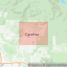
Named informally for Gold Hill, which is partially composed of this granite pluton. Type locality on Gold Hill, 3.5 mi north-northeast of Lone Mountain, Humboldt Mountain quad, northern Maricopa Co., central AZ. Exposed as isolated outcrops just outside study area on Gold Hill, Continental Mountain and smaller unnamed hills 3 to 4 mi north of Carefree basin. Consists of orange-pink to reddish-tan, coarse- to medium-grained, equigranular, massive, moderately to highly resistant granite with mostly quartz and potassium-feldspar crystals; locally cut by quartz veins and fine- to medium-grained aplite dikes (Kenny, 1986); locally faulted and mineralized with quartz-rich dikes and veins; weathers along parallel sets of joints into blocky fragments. Pleistocene and Holocene alluvial deposits (but not Tertiary fanglomerates) in study area contain Gold Hill clasts, which is why unit is included in this section of report. [Thickness not stated]. Intrudes Precambrian meta-argillite--phyllite complex. Age could be as old as Proterozoic or as young as Miocene. Mapped as Cretaceous (Wilson and others, 1957). May be associated with Laramide Orogeny igneous intrusions which formed well-known ore deposits of southern and western AZ (Nations and Stump, 1981). Report includes geologic map and cross section, and stratigraphic nomenclature table.
Source: GNU records (USGS DDS-6; Denver GNULEX).
For more information, please contact Nancy Stamm, Geologic Names Committee Secretary.
Asterisk (*) indicates published by U.S. Geological Survey authors.
"No current usage" (†) implies that a name has been abandoned or has fallen into disuse. Former usage and, if known, replacement name given in parentheses ( ).
Slash (/) indicates name conflicts with nomenclatural guidelines (CSN, 1933; ACSN, 1961, 1970; NACSN, 1983, 2005, 2021). May be explained within brackets ([ ]).

