- Usage in publication:
-
- Gold Hill Loess*
- Modifications:
-
- Overview
- Dominant lithology:
-
- Loess
- AAPG geologic province:
-
- Alaska East-Central region
Summary:
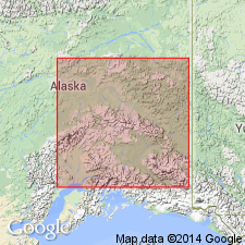
Unit is named the Gold Hill Loess. Name was informally used previously (Pewe, 1952). Consists of green, brown or tan massive loess. A white, rather gritty highly vitric ash, Ester Ash Bed is [enclosed] near base of formation. Dome Ash Bed is a ubiquitous thin white ash bed that is [enclosed] near the upper part of formation and is folded or faulted wherever exposed. Thickness ranges up to 55 m. Unconformably overlies, Cripple Gravel, Fox Gravel, Tanana Formation, and Dawson Cut Formation, or pre-Quaternary bedrock; unconformably underlies the Eva and Goldstream Formations. Is lateral equivalent of lower part of the Fairbanks Loess. Age is Pleistocene (Illinoian).
Source: GNU records (USGS DDS-6; Menlo GNULEX).
For more information, please contact Nancy Stamm, Geologic Names Committee Secretary.
Asterisk (*) indicates published by U.S. Geological Survey authors.
"No current usage" (†) implies that a name has been abandoned or has fallen into disuse. Former usage and, if known, replacement name given in parentheses ( ).
Slash (/) indicates name conflicts with nomenclatural guidelines (CSN, 1933; ACSN, 1961, 1970; NACSN, 1983, 2005, 2021). May be explained within brackets ([ ]).

