

- Usage in publication:
-
- Goathaunt member
- Modifications:
-
- Original reference
- Dominant lithology:
-
- Limestone
- Argillite
- Sandstone
- AAPG geologic province:
-
- Northern Rocky Mountain region
Summary:
Pg. 670-679. Goathaunt member of Siyeh formation. Massive impure dark-gray magnesian limestone, weathering buff; some interbeds of dolomitic metargillite and a few thin beds of sandstone. Molar teeth and shear structures common in upper part. Thickness 2,000+ feet. Can be studied throughout Glacier National Park, northwestern Montana. Most accessible on trail to Swift Current Pass. Underlies COLLENIA(?) FREQUENS zone and overlies COLLENIA SYMMETRICA zone of Siyeh formation. Age is pre-Cambrian (Belt series). [Goathaunt member of Siyeh limestone adopted by the USGS, ca. 1936.]
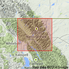
[Origin of name not stated, but probably Goathaunt Mountain, Glacier National Park, northwestern MT.]
Source: US geologic names lexicon (USGS Bull. 896, p. 832).

- Usage in publication:
-
- Goathaunt member
- Modifications:
-
- Principal reference
- Dominant lithology:
-
- Limestone
- Dolomite
- AAPG geologic province:
-
- Northern Rocky Mountain region
Summary:
Pg. 1895. Goathaunt member of Siyeh formation of Piegan group. Limestones, dolomites, and subordinate oolites, dolomitic sandstones, and argillites, thickly bedded; prevailingly dark gray. Mud breccias, abundant in northern exposures. Mud cracks common in carbonaceous layers. Thickness 2,000 to 3,200 feet. Overlies COLLENIA SYMMETRICA zone; separated from overlying Granite Park member by COLLENIA FREQUENS zone. Type locality designated.
Type locality: south wall of cirque between Mount Goathaunt and Mount Cleveland, Glacier National Park, northwestern MT. Well exposed in high peaks of Waterton-Glacier Parks.
Source: US geologic names lexicon (USGS Bull. 1200, p. 1531).
For more information, please contact Nancy Stamm, Geologic Names Committee Secretary.
Asterisk (*) indicates published by U.S. Geological Survey authors.
"No current usage" (†) implies that a name has been abandoned or has fallen into disuse. Former usage and, if known, replacement name given in parentheses ( ).
Slash (/) indicates name conflicts with nomenclatural guidelines (CSN, 1933; ACSN, 1961, 1970; NACSN, 1983, 2005, 2021). May be explained within brackets ([ ]).