

- Usage in publication:
-
- Goat Creek Formation
- Modifications:
-
- Named
- Dominant lithology:
-
- Arkose
- Argillite
- AAPG geologic province:
-
- Okanogan province
- Cascades province
Summary:
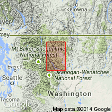
Unit is named the Goat Creek Formation for the creek whose headwaters drain the type section exposed in east end of drainage divide between Isabella Ridge and Sunrise Peak, sec. 4, T37N R20E and adjoining sec. 33, T38N R20E, Mazama 15' quad, Okanogan Co., WA. Extends from Buck Mountain northwest 21 mi to the northern boundary of the quad. Composed mainly of well-bedded arkose with subordinate shale in lower part. Unconformably overlies the volcanic and volcaniclastic rocks of the Buck Mountain Formation (new). Conformably underlies the black shale and roundstone granitoid conglomerate of the Panther Creek Formation (new). Measured section totals 5120 ft. Is nonfossiliferous and mildly metamorphosed. Probably correlative with the Jackass Mountain Group of Coates (1970), most likely "the Upper Graywacke Member" of Jeletzky (1972) is Aptian(?) [Early Cretaceous] age.
Source: GNU records (USGS DDS-6; Menlo GNULEX).
For more information, please contact Nancy Stamm, Geologic Names Committee Secretary.
Asterisk (*) indicates published by U.S. Geological Survey authors.
"No current usage" (†) implies that a name has been abandoned or has fallen into disuse. Former usage and, if known, replacement name given in parentheses ( ).
Slash (/) indicates name conflicts with nomenclatural guidelines (CSN, 1933; ACSN, 1961, 1970; NACSN, 1983, 2005, 2021). May be explained within brackets ([ ]).