The National Geologic Map Database is migrating to a new infrastructure. We apologize for any service disruptions during this process.
|
|---|


- Usage in publication:
-
- Glorieta sandstones
- Modifications:
-
- Original reference
- Dominant lithology:
-
- Sandstone
- AAPG geologic province:
-
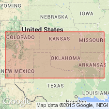
- Estancia basin
- Palo Duro basin
Summary:
Pg. 257, 262; and Conspectus of geol. fms. of New Mexico, p. 2, 7. Glorietta sandstones. Main body of Dakotan series (Cretaceous) around southern end of Rocky Mountains. Thickness 300 feet. [Recognized around Glorieta Mesa, Santa Fe and San Miguel Counties, central northern New Mexico. Age is Permian.]
Source: US geologic names lexicon (USGS Bull. 896, p. 831).
- Usage in publication:
-
- Glorieta sandstone member
- Modifications:
-
- Revised
- AAPG geologic province:
-
- Estancia basin
- Palo Duro basin
Summary:
Glorietta sandstone is top member of Yeso formation. It consists of 500 feet of massive sandstone, even-grained and white when broken open but weathering reddish brown. [Recognized around Glorieta Mesa, Santa Fe and San Miguel Counties, central northern New Mexico. Age is Permian.]
Source: US geologic names lexicon (USGS Bull. 896, p. 831).
- Usage in publication:
-
- Glorieta sandstone
- Modifications:
-
- Revised
- AAPG geologic province:
-
- Estancia basin
- Palo Duro basin
Summary:
Pg. 111, 118, 119, 126. Glorieta sandstone, basal member of Upper Trias, outcrops along valley of Pecos from Glorieta Mesa downstream to somewhere between Puerto de Luna and Fort Sumner, and at Santa Rosa, [Santa Fe and San Miguel Counties, central northern New Mexico]. Near Anton Chico it rests on Yeso formation. [Age is Permian.]
Source: US geologic names lexicon (USGS Bull. 896, p. 831).
- Usage in publication:
-
- Glorieta sandstone
- Modifications:
-
- Areal extent
- AAPG geologic province:
-
- Estancia basin
- Palo Duro basin
Summary:
Pg. 295, 296. Glorieta sandstone. Baker has confused Glorieta sandstone in parts of area with the younger (Late Triassic) Santa Rosa sandstone. The Glorieta sandstone is coarse, gray, massive, 300 to 500 feet thick, underlies San Andreas [Andres] limestone, overlies Yeso formation, and is of Permian age.
Source: US geologic names lexicon (USGS Bull. 896, p. 831).

- Usage in publication:
-
- Glorieta sandstone
- Modifications:
-
- Overview
- AAPG geologic province:
-
- Estancia basin
- Palo Duro basin
Summary:
Glorieta sandstone. As there is no formation between San Andres limestone and Yeso formation as defined (now called Yeso member of Cupadera formation), the sandstone of Glorieta Mesa, Santa Fe and San Miguel Counties, central northern New Mexico, is top part of Yeso member of that area. Age is Permian.
Source: US geologic names lexicon (USGS Bull. 896, p. 831).
- Usage in publication:
-
- Glorieta sandstone member*
- Modifications:
-
- Revised
- AAPG geologic province:
-
- Las Vegas-Raton basin
- Palo Duro basin
Summary:
Glorieta sandstone member of San Andres formation of Manzano group. In northern New Mexico, Glorieta is basal member of San Andres formation (†Chupadera formation abandoned). Overlies Yeso formation; underlies unnamed gray, thin- to thick-bedded limestones of San Andres. Age is Early Permian (Leonard).
Source: Modified from GNU records (USGS DDS-6; Denver GNULEX).
- Usage in publication:
-
- Glorieta sandstone
- Modifications:
-
- Principal reference
- Revised
- Dominant lithology:
-
- Sandstone
- AAPG geologic province:
-
- Orogrande basin
- Palo Duro basin
Summary:
Pg. 1662-1664. Glorieta sandstone. Because of its wide distribution, persistence of lithology, bold topographic expression, and stratigraphic importance, Glorieta is considered to be formation (previously basal member of San Andres formation). Overlies Yeso formation; underlies San Andres formation. Maximum thickness 278 feet in Zuni Mountains. [Age is Early Permian (Leonard).] Type locality designated.
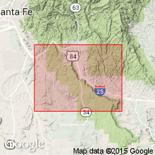
Type section: Glorieta Mesa 1 mi west of village of Rowe, in south-central part T. 15 N., R. 12 E., [in vicinity of Lat. 35 deg. 29 min. 32 sec. N., Long. 105 deg. 41 min. 36 sec. W., Rowe 7.5-min quadrangle], San Miguel Co., central northern NM.
Source: US geologic names lexicon (USGS Bull. 1200, p. 1530).
- Usage in publication:
-
- Glorieta sandstone member*
- Modifications:
-
- Areal extent
- AAPG geologic province:
-
- Estancia basin
- Palo Duro basin
Summary:
Glorieta sandstone member of San Andres formation. Shown on columnar section as basal member of San Andres formation. Thickness 100 to 250 feet. Underlies unnamed limestone member; overlies Yeso formation. [Age is Permian.]
Source: US geologic names lexicon (USGS Bull. 1200, p. 1530).
- Usage in publication:
-
- Glorieta sandstone member*
- Modifications:
-
- Areal extent
- AAPG geologic province:
-
- Las Vegas-Raton basin
Summary:
Glorieta sandstone member of San Andres formation. Described in northwestern Mora County, central northern New Mexico, where it is about 266 feet thick near Ocate. Underlies Bernal formation; overlies Yeso formation in extreme southwestern part of mapped area and elsewhere Sangre de Cristo formation. [Age is Permian.]
Source: US geologic names lexicon (USGS Bull. 1200, p. 1530).
- Usage in publication:
-
- Glorieta sandstone*
- Modifications:
-
- Revised
- AAPG geologic province:
-
- Estancia basin
- San Juan basin
Summary:
Glorieta sandstone considered of formational rank. Age is Permian.
Source: US geologic names lexicon (USGS Bull. 1200, p. 1530).
- Usage in publication:
-
- Glorieta sandstone member
- Modifications:
-
- Areal extent
- AAPG geologic province:
-
- Orogrande basin
Summary:
Pg. 7 (fig. 2), 10, 11, pl. 1. Glorieta sandstone member of San Andres formation. Described in Puertecito quadrangle where it is about 230 feet thick. Underlies unnamed middle evaporite member. Gradationally overlies Los Vallos member of Yeso formation; contact placed above uppermost siltstone bed, so that basal part of Glorieta consists entirely of sandstone, which is pinkish at base. [Age is Permian.]
Source: US geologic names lexicon (USGS Bull. 1200, p. 1530).
- Usage in publication:
-
- Glorieta Sandstone*
- Modifications:
-
- Areal extent
- AAPG geologic province:
-
- Orogrande basin
Summary:
The Permian Hondo Sandstone Member of the San Andres Limestone and the Glorieta Sandstone in Otero, Lincoln, and Socorro Cos., Orogrande basin, NM have been thought to be identical units. Both are even bedded, have small scale cross laminations, and are gray. The Hondo has clear quartz, sparse rose quartz, smoky quartz, and is slightly coarser grained than the Glorieta. Both are present between Lone Mountain in sec. 22, T 6 S, R 11 E and Riverside in sec. 21, T 11 S, R 19E on Rio Hondo. Cross sections. Block diagrams. The two sandstone are recognized in this report as to two different units separated by an unnamed limestone of the San Andres. Hondo, the younger sandstone, overlies the unnamed limestone, and Glorieta underlies the unnamed limestone. The two sandstones may merge to the north but no proof exists. Hondo thickens toward southeast NM whereas Glorieta wedges out to the southeast. In many areas, only one sandstone is present. The unnamed limestone thins northward. Glorieta and San Andres were deposited in a marine environment.
Source: GNU records (USGS DDS-6; Denver GNULEX).
For more information, please contact Nancy Stamm, Geologic Names Committee Secretary.
Asterisk (*) indicates published by U.S. Geological Survey authors.
"No current usage" (†) implies that a name has been abandoned or has fallen into disuse. Former usage and, if known, replacement name given in parentheses ( ).
Slash (/) indicates name conflicts with nomenclatural guidelines (CSN, 1933; ACSN, 1961, 1970; NACSN, 1983, 2005, 2021). May be explained within brackets ([ ]).