The National Geologic Map Database is migrating to a new infrastructure. We apologize for any service disruptions during this process.
|
|---|


- Usage in publication:
-
- Glenn formation*
- Modifications:
-
- Original reference
- Dominant lithology:
-
- Shale
- Sandstone
- Limestone
- AAPG geologic province:
-
- South Oklahoma folded belt
Summary:
Glenn formation. Friable blue shale, with thin brown sandstones and occasional thin limestones. Thickness estimated to be 1,000 to 3,000 feet. Overlies Caney shale and may include highest Carboniferous rocks exposed in Tishomingo quadrangle. Older than Franks conglomerate (new). Age is Carboniferous (Pennsylvanian) based on fossils.
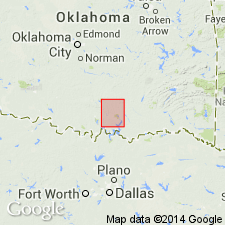
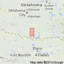
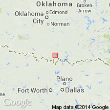
Named from town of Glenn, Carter Co., central southern OK. Exposed in western part of Tishomingo quadrangle and to the west along southern edge of Arbuckle Mountains.
Source: US geologic names lexicon (USGS Bull. 896, p. 828); supplemental information from GNU records (USGS DDS-6; Denver GNULEX).
- Usage in publication:
-
- Glenn formation
- Modifications:
-
- Revised
- AAPG geologic province:
-
- South Oklahoma folded belt
Summary:
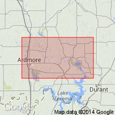
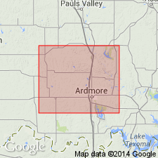
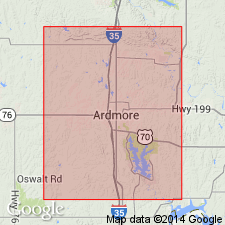
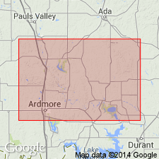
Glenn formation of Ardmore basin divided into (descending) Hoxbar member, Deese member, Cup Coral member, Otterville limestone member, and Springer member. Total thickness 12,000 to 19,000 feet. Overlies Carboniferous Caney shales; underlies unnamed Carboniferous redbeds. Fossiliferous (brachiopods, bryozoans, mollusks, bivalves, gastropods, pelecypods, cephalopods, cidaroids). Age is Pennsylvanian. Exposed between Arbuckle Mountains to north and Criner Hills to south, in Carter and Love Counties, central southern Oklahoma. Report includes geologic map, structure map, cross sections, correlation chart, fossil lists.
Source: US geologic names lexicon (USGS Bull. 896, p. 828); supplemental information from GNU records (USGS DDS-6; Denver GNULEX).
- Usage in publication:
-
- Glenn formation
- Modifications:
-
- Revised
- Biostratigraphic dating
- AAPG geologic province:
-
- South Oklahoma folded belt
Summary:
Pg. 331-347. We are convinced it was not Taff's intention to include in Glenn formation the beds called Hoxbar member by Goldston. Typical Glenn includes only Deese and "Cup Coral" members of Goldston. [For their views regarding Otterville and Springer members of Goldston see under Otterville and Springer.]
Source: US geologic names lexicon (USGS Bull. 896, p. 828).
- Usage in publication:
-
- Glenn formation
- Modifications:
-
- Areal extent
- Overview
Summary:
Pg. 25. Glenn formation. According to Goldston the Glenn formation is exposed only south of Arbuckle Mountains, in southwest Johnston and northern Carter Counties, and extends across east-central Carter into northern Love County [central southern Oklahoma].
Source: US geologic names lexicon (USGS Bull. 896, p. 828).
- Usage in publication:
-
- Glenn formation
- Modifications:
-
- Revised
Summary:
[See entry under Hoxbar member.]
Source: US geologic names lexicon (USGS Bull. 896, p. 828).
- Usage in publication:
-
- Glenn formation
- Modifications:
-
- Revised
- Mapped
Summary:
Mapped Glenn formation as underlying Hoxbar formation and overlying Springer formation.
Source: US geologic names lexicon (USGS Bull. 896, p. 828).
- Usage in publication:
-
- Glenn formation
- Modifications:
-
- Not used
- AAPG geologic province:
-
- South Oklahoma folded belt
Summary:
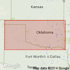
Pg. 7-21. Recognized following units in Carter County, central southern Oklahoma (descending): Hoxbar formation, 4,000+/- feet; Deese formation, 5,000+/- feet; Dornick Hills formation 1,500 to 4,000 feet (including Otterville limestone, 25+/- feet thick, in lower part); and Springer formation, 3,000 or more feet thick.
Source: US geologic names lexicon (USGS Bull. 896, p. 828).
- Usage in publication:
-
- Glenn formation†
- Modifications:
-
- Abandoned
Summary:
Springer formation was included in Glenn formation by Taff in Tishomingo folio, but was excluded from Glenn by Girty, Roundy, and Miser. Best solution is to drop it, as suggested by Gould (personal commun.).
Source: US geologic names lexicon (USGS Bull. 896, p. 828).
- Usage in publication:
-
- Glenn formation [of Taff (1903)]
- Modifications:
-
- Overview
Summary:
Springer formation is lowest subdivision of Glenn formation of Taff.
Source: US geologic names lexicon (USGS Bull. 896, p. 828).
- Usage in publication:
-
- Glenn formation†
- Modifications:
-
- Abandoned
Branson, C.C., 1957, Old stratigraphic names made available: Oklahoma Geology Notes, v. 17, no. 11, p. 99-103.
Summary:
Pg. 101. †Glenn formation. Abandoned by the Oklahoma Geological Survey. Unit is lumping of four series; name applies to all rocks below the Pontotoc and above the Caney shale.
Source: US geologic names lexicon (USGS Bull. 1200, p. 1525).
For more information, please contact Nancy Stamm, Geologic Names Committee Secretary.
Asterisk (*) indicates published by U.S. Geological Survey authors.
"No current usage" (†) implies that a name has been abandoned or has fallen into disuse. Former usage and, if known, replacement name given in parentheses ( ).
Slash (/) indicates name conflicts with nomenclatural guidelines (CSN, 1933; ACSN, 1961, 1970; NACSN, 1983, 2005, 2021). May be explained within brackets ([ ]).