

- Usage in publication:
-
- Glenn Shale*
- Modifications:
-
- Named
- Biostratigraphic dating
- Dominant lithology:
-
- Shale
- Argillite
- Siltstone
- Limestone
- AAPG geologic province:
-
- Alaska East-Central region
Summary:
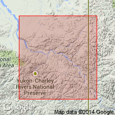
Named for Glenn Creek. Type section designated along banks and bed of Washington Creek, north-flowing tributary of Yukon River, 2 to 4 mi northwest of bench mark 2452 (Glenn) from NW/4 sec.24 T5N R26E to NW/4 sec.12 T5N R26E, Charley River B-3 (1:63,360) quad, AK. Recognized over area more than 2000 sq mi. Consists predominantly of grayish-black fissile carbonaceous shale which grades upward into grayish-black massive argillite and siltstone, and dark-gray fossiliferous limestone. Is about 5000 ft thick. Unconformably overlies Tahkandit Limestone or Step Conglomerate (new); Conformably underlies Keenan Quartzite (new); locally, unconformably underlies Cretaceous or Tertiary sedimentary rocks. Fossils identified by N.J. Silberling (listed in table) indicate unit ranges in age from Middle Triassic (Ladinian) to Early Cretaceous (probably Valanginian).
Source: GNU records (USGS DDS-6; Menlo GNULEX).
For more information, please contact Nancy Stamm, Geologic Names Committee Secretary.
Asterisk (*) indicates published by U.S. Geological Survey authors.
"No current usage" (†) implies that a name has been abandoned or has fallen into disuse. Former usage and, if known, replacement name given in parentheses ( ).
Slash (/) indicates name conflicts with nomenclatural guidelines (CSN, 1933; ACSN, 1961, 1970; NACSN, 1983, 2005, 2021). May be explained within brackets ([ ]).