- Usage in publication:
-
- Glencoe Member
- Modifications:
-
- Original reference
- Dominant lithology:
-
- Limestone
- Bentonite
- Shale
- AAPG geologic province:
-
- Ozark uplift
- Illinois basin
- Iowa shelf
- Wisconsin arch
Summary:
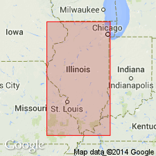
Pg. 110, 235. Glencoe Member of Spechts Ferry Formation of Decorah subgroup [informal] of Galena Group. Present in Missouri, Iowa, Illinois, Minnesota, and Wisconsin. Bentonite, limestone, and shale. Bentonite (near base of member) is commonly 1 to 3 inches thick, locally 8 inches thick, and occurs in a 1- to 2-foot zone of interbedded green, gray, or brown shale with thin beds of fine-grained limestone, coquina, or calcarenite. This is most persistent Ordovician bentonite in Mississippi Valley. Thickness commonly 5 to 8 feet near Mississippi River but thins to east; maximum thickness about 15 feet near Decorah, Iowa. Upper member of formation; overlies Castlewood Member (new); underlies Mincke Member of Kings Lake Formation (both new). Age is Middle Ordovician (Champlainian).
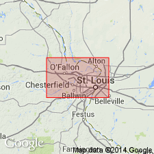
Type section: exposure in south bluff of Meramec River along St. Louis-San Francisco RR, 0.25 mi northeast of Mincke Siding, near center E/2 SE/4 SE/4 sec. 21, T. 44 N., R. 4 E., Manchester 7.5-min quadrangle, St. Louis Co., eastern MO. Named from village of Glencoe, St. Louis Co., eastern MO, 3 miles west of type section.
["Subgroup" not recognized as a formal stratigraphic rank term (CSN, 1933; ACSN, 1961, 1970; NACSN, 1983, 2005, 2021). Considered informal and should not be capitalized.]
Source: US geologic names lexicon (USGS Bull. 1350, p. 291); supplemental information from GNU records (USGS DDS-6; Reston GNULEX).

- Usage in publication:
-
- Glencoe Member
- Modifications:
-
- Overview
- AAPG geologic province:
-
- Illinois basin
Summary:
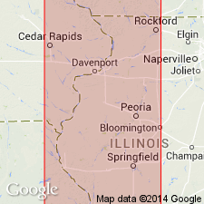
Pg. 74 (fig. O-22), 75. Glencoe Member of Spechts Ferry Formation of Decorah subgroup [informal] of Galena Group (after Templeton and Willman, 1963). Commonly 5 to 8 feet thick near Mississippi River but thins to east. Largely green shale, but it contains beds of calcarenite, greenish gray argillaceous limestone, and dark purplish gray coarse-grained limestone. The most persistent and thickest Ordovician bentonite [Millbrig K-bentonite Bed], commonly 1 to 3 inches thick and locally as much as 8 inches thick, occurs in the lower part of the Glencoe Member, interbedded with green, gray, or brown shale. Locally the bentonite is altered to a distinctive, hard, pink bed, which is almost entirely potash feldspar. Overlies Castlewood Member of Spechts Ferry. Fossiliferous; some beds are a coquina of PIONODEMA SUBAEQUATA. In upper Mississippi River valley, trilobite ISOTELUS GIGAS is common in argillaceous limestone bed near base. Age is late Middle Ordovician (Trentonian).
["Subgroup" not recognized as a formal stratigraphic rank term (CSN, 1933; ACSN, 1961, 1970; NACSN, 1983, 2005, 2021). Considered informal and should not be capitalized.]
Source: Publication.

- Usage in publication:
-
- Glencoe Member
- Modifications:
-
- Revised
- AAPG geologic province:
-
- Wisconsin arch
Summary:
Pg. 43-44. Glencoe Member of Spechts Ferry Formation. Revised in Illinois and Wisconsin to include Millbrig Bentonite Bed at or near base. Overlies Castlewood Member of Spechts Ferry Formation. Age is Middle Ordovician. [See entry under Millbrig.]
Source: Inferred from US geologic names lexicon (USGS Bull. 1564, p. 107-108).

- Usage in publication:
-
- Glencoe Shale Member*
- Modifications:
-
- Adopted
- AAPG geologic province:
-
- Illinois basin
- Ozark uplift
Summary:
Glencoe Shale Member of Spechts Ferry Formation of Decorah Group. [Author follows usage of Thompson (1991).] Overlies Castlewood Member. Contains Millbrig K-bentonite Bed of Willman and Kolata (1978). Published isotopic ages for Millbrig are 453.1 +/-1.8 Ma (Tucker and others, 1990), and 454.1 +/-2.1 Ma (Kunk and others, 1985). Age is Middle Ordovician (Mohawkian).
Source: Modified from GNU records (USGS DDS-6; Reston GNULEX).
- Usage in publication:
-
- Glencoe Shale Member*
- Modifications:
-
- Overview
- AAPG geologic province:
-
- Illinois basin
GNC Staff, 2012, [U.S. Geologic Names Committee remarks on Ordovician geologic units of the Upper Mississippi Valley region, Illinois, Iowa, Minnesota, Missouri, Wisconsin]: U.S. Geological Survey, unpublished Geologic Names Committee note
Summary:
Glencoe Shale Member of Spechts Ferry Formation of Decorah Group. Recognized in St. Louis region, Missouri and Illinois. Middle part includes Millbrig K-bentonite Bed (=base of Chatfieldian). Overlies Castlewood Limestone Member. Age is Late Ordovician (Mohawkian; latest Turinian to earliest Chatfieldian).
Use discontinued by the State Geological Surveys of Illinois, Iowa, Minnesota, and Wisconsin. Rocks reallocated to Spechts Ferry Shale Member of Decorah Formation of Galena Group (Sinnipee Group in Wisconsin). See stratigraphic charts of: Illinois Geol. Survey Map, no. 14 (Kolata, 2005); Iowa Geol. Survey Gdbk., no. 24, pt. 1 Contrib. Papers (Witzke and Ludvigson, 2005, p. 3-21); Minnesota Geol. Survey Rpt. Inv., no. 65 (Mossler, 2008); Wisconsin Geol. Survey Educ. Ser., no. 51 (2011). See also Kolata and others (1996) entry under Decorah.
Source: N.R. Stamm, compiler, US geologic names lexicon, Geolex.
For more information, please contact Nancy Stamm, Geologic Names Committee Secretary.
Asterisk (*) indicates published by U.S. Geological Survey authors.
"No current usage" (†) implies that a name has been abandoned or has fallen into disuse. Former usage and, if known, replacement name given in parentheses ( ).
Slash (/) indicates name conflicts with nomenclatural guidelines (CSN, 1933; ACSN, 1961, 1970; NACSN, 1983, 2005, 2021). May be explained within brackets ([ ]).

