

- Usage in publication:
-
- Glen Eyrie formation*
- Modifications:
-
- Named
- Dominant lithology:
-
- Sandstone
- AAPG geologic province:
-
- Denver basin
Summary:
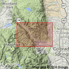
[Spelled Gleneyrie by Finlay.] Named for Glen Eyrie Creek [west of Manitou, El Paso Co, CO in the Denver basin]. [No type locality designated.] Exposed in a stream bed in Quarry Canyon a mile northeast of Manitou. Has an outcrop width of an eighth of a mi and length of 3 mi. Is a 40 ft, gray to buff, resistant, finely laminated sandstone made up almost entirely of quartz grains. Has thin bands of black shale near base in which LEPIDODENDRON remains have been found. These are the first plant fossil remains of Pennsylvanian or Pottsville age found in the Rocky Mountain region. Overlies probable Millsap equivalent, or probably Mississippian rocks. Unconformably underlies Fountain formation.
Source: GNU records (USGS DDS-6; Denver GNULEX).

- Usage in publication:
-
- Glen Eyrie shale*
- Modifications:
-
- Areal extent
- AAPG geologic province:
-
- Las Animas arch
Summary:
Extended into subsurface of Otero County, Colorado, on the Las Animas arch. Overlies Manitou limestone and underlies Fountain formation. Age is Pennsylvanian. Report includes correlation chart.
Source: Modified from GNU records (USGS DDS-6; Denver GNULEX).
For more information, please contact Nancy Stamm, Geologic Names Committee Secretary.
Asterisk (*) indicates published by U.S. Geological Survey authors.
"No current usage" (†) implies that a name has been abandoned or has fallen into disuse. Former usage and, if known, replacement name given in parentheses ( ).
Slash (/) indicates name conflicts with nomenclatural guidelines (CSN, 1933; ACSN, 1961, 1970; NACSN, 1983, 2005, 2021). May be explained within brackets ([ ]).