The National Geologic Map Database is migrating to a new infrastructure. We apologize for any service disruptions during this process.
|
|---|


- Usage in publication:
-
- Glen Dean limestone
- Modifications:
-
- Named
- Dominant lithology:
-
- Limestone
- Sandstone
- Shale
- AAPG geologic province:
-
- Illinois basin
Summary:
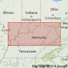
Named Glen Dean limestone. Composed of limestone, shale and a little sandstone. Abundantly fossiliferous, particularly crinoid ossicles. Ranges in thickness from 40 to 180 ft. Underlain by Hardinsburg sandstone; overlain by Tar Springs sandstone.
Source: GNU records (USGS DDS-6; Reston GNULEX).
- Usage in publication:
-
- Glen Dean Limestone*
- Modifications:
-
- Overview
- AAPG geologic province:
-
- Illinois basin
Summary:
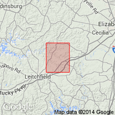
Designated Glen Dean Limestone. "Limestone and shale: Limestone is thin bedded to massive, gray or brownish gray, crystalline, argillaceous; thick-bedded limestone locally contains thin, highly fossiliferous calcareous shale beds; fossils include crinoid columnals, abundant Archimedes sp., Pentremites sp., and Pterotocrinus sp.; basal 5 to 10 feet of formation is gray clay shale; upper 15 to 25 feet is gray calcareous shale containing thin limestone beds; uppermost bed is thin cherty limestone." Thickness ranges from 40 to 55 ft. Underlain by Hardinsburg Sandstone; overlain by Leitchfield Formation.
Source: GNU records (USGS DDS-6; Reston GNULEX).

- Usage in publication:
-
- Glen Dean Limestone
- Modifications:
-
- Overview
- AAPG geologic province:
-
- Illinois basin
Summary:
Glen Dean Limestone is current (1975) usage of Illinois Geological Survey. In western Illinois, it is considered the upper formation of the Okaw Group. "The Glen Dean is composed of limestone and various amounts of dolomite and shale. The limestone is light to medium brownish gray, coarse grained, and fossiliferous. Part of it are oolitic and some beds are cherty. The shales are dark greenish gray and are generally fossiliferous." The blastoid Pentremites spicatus is characteristic. Occurs in southern Illinois, thickens from 5-15 ft in the north to 65-80 ft in the south. Underlain by Hardinsburg Sandstone; overlain by Tar Springs Sandstone.
Source: GNU records (USGS DDS-6; Reston GNULEX).
- Usage in publication:
-
- Glen Dean Limestone
- Modifications:
-
- Overview
- AAPG geologic province:
-
- Illinois basin
Anderson, K.H., 1979, Geologic Map of Missouri: Missouri Geological Survey
Summary:
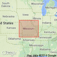
Current (1979) usage of Missouri Geological Survey is Glen Dean Limestone. Occurs in southeast Missouri. Mapped with other Chester units.
Source: GNU records (USGS DDS-6; Reston GNULEX).

- Usage in publication:
-
- Glen Dean Limestone
- Modifications:
-
- Overview
- AAPG geologic province:
-
- Illinois basin
Summary:
Current (1986) usage of Indiana Geological Survey is Glen Dean Limestone of Stephensport Group, "a thick-bedded skeletal to oolitic to biomicritic limestone 9 to 31 feet thick. Its typical fauna consists of brachiopods, blastoids of the genus Pentremites, and bryozoans including Archimedes ." Surface exposures occur in Indiana from Greene Co. in south-central Indiana southward to the Ohio River. It is recognized in the subsurface southwestward from Greene Co. Conformably underlain by Hardinsburg Formation. Conformably overlain by Tar Springs Formation or disconformably by Mansfield Formation (Morrowan).
Source: GNU records (USGS DDS-6; Reston GNULEX).
- Usage in publication:
-
- Glen Dean Limestone
- Modifications:
-
- Overview
- AAPG geologic province:
-
- Illinois basin
Summary:
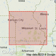
Current usage (1986) of Missouri Geological Survey is Glen Dean Limestone. In Missouri, it consists of limestone and numerous interbedded layers of shale. The limestone is light gray and coarsely and finely crystalline or oolitic. Stratification is very irregular. Cross-bedding is common. Both shale and limestone are fossiliferous. Fossils are bryozoans, blastoids, brachiopods, horn corals, and crinoids. Thickness is 65 to 80 feet. Conformably underlain by Hardinsburg Sandstone; overlain both conformably and disconformably by the Tar Springs Sandstone. Outcrop is confined to Mississippi River bluff in east-central Perry Co., MO.
Source: GNU records (USGS DDS-6; Reston GNULEX).
- Usage in publication:
-
- Glen Dean Limestone
- Modifications:
-
- Revised
- AAPG geologic province:
-
- Illinois basin
Summary:
The Pope Group, here revised from Megagroup and apparently reinstated, comprises strata from the base of the Aux Vases Sandstone to the top of the Kinkaid Formation, which includes the Glen Dean Limestone. According to authors, "The Pope Group is a lithostratigraphic unit distinct from its chronostratigraphic counterpart, the Chesterian Series." The lower boundaries of the two differ slightly. The group is about 1,425 ft thick in the Waltersburg quad, but the lowermost formations, from the Aux Vases Sandstone up to the Fraileys Shale Member of the Golconda Formation do not crop out. This interval is 384 ft thick in the Austin Roberts No. 1 Well. [See subunit list in index portion of Pope summary record. Publication does not name the units between the Aux Vases and the Fraileys and therefore these have not been included in the list.]
Source: GNU records (USGS DDS-6; Reston GNULEX).
For more information, please contact Nancy Stamm, Geologic Names Committee Secretary.
Asterisk (*) indicates published by U.S. Geological Survey authors.
"No current usage" (†) implies that a name has been abandoned or has fallen into disuse. Former usage and, if known, replacement name given in parentheses ( ).
Slash (/) indicates name conflicts with nomenclatural guidelines (CSN, 1933; ACSN, 1961, 1970; NACSN, 1983, 2005, 2021). May be explained within brackets ([ ]).