The National Geologic Map Database is migrating to a new infrastructure. We apologize for any service disruptions during this process.
|
|---|


- Usage in publication:
-
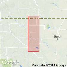
- Glass Mountain formation
- Modifications:
-
- Original reference
- AAPG geologic province:
-
- Anadarko basin
Cragin, F.W., 1897, Observations on the Cimarron series: American Geologist, v. 19, p. 351-363.
Summary:
Pg. 353, 355. Glass Mountain formation. Includes all beds, 160 feet thick, above Salt Plain measures and below Cave Creek formation, the equivalent Cedar Hills sandstones and Flower-pot shales of Kansas section not being satisfactorily identified in Oklahoma. Included in Salt Fork division (Cimarron group). Age is Permian.
Named from Glass (also spelled Gloss) Mountains, Major Co., northwestern OK.
[†Glass Mountain formation of Cimarron group abandoned ca. 1936. See "Modern classifications of the Permian rocks of Kansas and Nebraska," compiled by M.G. Wilmarth, Secretary of Committee on Geologic Names, USGS unpub. corr. chart, Oct. 1936, 1 sheet.]
Source: US geologic names lexicon (USGS Bull. 896, p. 825).
For more information, please contact Nancy Stamm, Geologic Names Committee Secretary.
Asterisk (*) indicates published by U.S. Geological Survey authors.
"No current usage" (†) implies that a name has been abandoned or has fallen into disuse. Former usage and, if known, replacement name given in parentheses ( ).
Slash (/) indicates name conflicts with nomenclatural guidelines (CSN, 1933; ACSN, 1961, 1970; NACSN, 1983, 2005, 2021). May be explained within brackets ([ ]).