


- Usage in publication:
-
- Glasford Formation
- Modifications:
-
- Original reference
- Dominant lithology:
-
- Till
- AAPG geologic province:
-
- Illinois basin
Summary:
Pg. 12 (fig. 1), 50 (fig. 6), 52-59, 188-189 (measured section). Glasford Formation. Most widespread formation of glacial origin in Illinois, recognized in western half and southern part of state. Consists of glacial tills interbedded with outwash deposits, overlain by accretion-gley deposits at top. At type section, thickness 35 feet, underlies Markham Silt Member of Roxana Silt and overlies Banner Formation. Age is Pleistocene (Illinoian to Sangamonian).
Subdivided into (alphabetical): Berry Clay Member, Duncan Mills Member, Hagarstown Member, Hulick Till Member, Kellerville Till Member, Mulberry Grove Silt Member, Ogle Till Member, Radnor Till Member, Roby Silt Member, Smithboro Till Member, Sterling Till Member, Toulon Member, Vandalia Till Member, and Winslow Till Member. [See also entries under individual members.] The Glasford is undivided in southern areas of Illinois.
Type section (=Banner Formation type section): Tindall School section, in borrow pit [on west side of U.S. Highway 24/IL Highway 9, a few mi southwest of Glasford], in SW/4 SW/4 NE/4 sec. 31, T. 7 N., R. 6 E., [approx. Lat. 40 deg. 32 min. 42 sec. N., Long. 89 deg. 51 min. 40 sec. W., Glasford 15-min quadrangle], Peoria Co., west-central IL. Named from village of Glasford, Peoria Co., west-central IL.
[Additional locality information from USGS GNIS database and USGS historical topographic map collection TopoView; accessed on June 9, 2018.]
Source: Publication; US geologic names lexicon (USGS Bull. 1520, p. 114).

- Usage in publication:
-
- Glasford Formation
- Modifications:
-
- Areal extent
- AAPG geologic province:
-
- Illinois basin
Summary:
Glasford is most extensive Quaternary lithostratigraphic unit in IL. Southern boundary marks the southernmost extent of continental glaciation in North America. In report area, unit is found only in the extreme northeast corner of the Creal Springs quad., where it overlies the Oak formation (new informal name). Underlies Roxana Silt. Though Lineback (1979) interpreted the till in this area to represent the Vandalia Member of the Glasford, authors here have classified it as undifferentiated Glasford. Distribution is patchy. Thickness of 3.4 m recorded in one boring. Described in the study area as generally a silt-loam, but ranging to silty clay loam and loam. Coarse clasts mainly sandstone, coal, and chert from local bedrock, with rare igneous and metamorphic pebbles. High percentage of kaolinite plus chlorite and illite.
Source: GNU records (USGS DDS-6; Reston GNULEX).
- Usage in publication:
-
- Glasford Formation
- Modifications:
-
- Revised
- AAPG geologic province:
-
- Illinois basin
Summary:
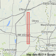
Glasford Formation in Effingham Co., IL, is divided into (ascending) Smithboro Till Member, Mulberry Grove Member, Fort Russell till facies of the Vandalia Till Member, and the Berry Clay Member. The Fort Russell has lithic parameters intermediate to that of the Smithboro and Vandalia Till Members. 23 ft of the Fort Russell till have been described by Kettles (1980) just west of the study area. This facies of the Vandalia is probably the dominant, uppermost Glasford till unit underlying most of Bishop Township.
Source: GNU records (USGS DDS-6; Reston GNULEX).
- Usage in publication:
-
- Glasford Formation
- Modifications:
-
- Areal extent
- AAPG geologic province:
-
- Illinois basin
Summary:
Glasford Formation in north-central Clark Co., east-central IL, has four members: (ascending) Smithboro Till, Mulberry Grove, Vandalia Till, and Berry Clay. These units overlie the Banner Formation, the Martinsville sand, and the Petersburg Silt, and underlie the Pearl Formation, the Peyton Colluvium, and the Cahokia Alluvium. In this report, the Berry Clay, normally an upper member of the Glasford, includes soft, gleyed diamicton at the top of the Sangamonian Pearl Formation. The Glasford is at least 180.4 ft thick in the Martinsville alternative site buried valley. About 30 ft is exposed in several outcrops adjacent to and east of the study area.
Source: GNU records (USGS DDS-6; Reston GNULEX).
For more information, please contact Nancy Stamm, Geologic Names Committee Secretary.
Asterisk (*) indicates published by U.S. Geological Survey authors.
"No current usage" (†) implies that a name has been abandoned or has fallen into disuse. Former usage and, if known, replacement name given in parentheses ( ).
Slash (/) indicates name conflicts with nomenclatural guidelines (CSN, 1933; ACSN, 1961, 1970; NACSN, 1983, 2005, 2021). May be explained within brackets ([ ]).