- Usage in publication:
-
- Gilmer Limestone
- Modifications:
-
- Named
- Dominant lithology:
-
- Limestone
- Shale
- AAPG geologic province:
-
- East Texas basin
Summary:
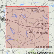
Name applied to a subsurface unit at the top of the Louark Group in northeast TX, East Texas basin. This name replaces prior use of terms "Cotton Valley limestone" or "Haynesville limestone." Is separated from Bossier Formation, basal formation of Cotton Valley Group, by a major unconformity and has not been [formally?] assigned to the Cotton Valley. Term Haynesville not satisfactory because it has been used for a different Jurassic unit. Unconformably overlies Buckner Formation of Louark shelfward or Smackover Formation of Louark basinward. Type well is the Arkansas Louisiana Gas Co., Indian Rock Gas Unit 2, Maria Finolia Flores Survey A-2, Gilmer Field, Upshur Co, TX between 11,620 and 11,940 ft. Three other "typical" wells listed. Areal extent map shows Gilmer only in northeast TX. E-log N-S cross section. Consists of gray to dark gray to brown, dense, micritic limestone, gray to brown oolitic and pseudo-oolitic limestone, argillaceous limestone, and thin beds of gray shale. Ranges between 240 and 350 ft thick in wells described. Correlation chart. Of Late Jurassic age.
Source: GNU records (USGS DDS-6; Denver GNULEX).
For more information, please contact Nancy Stamm, Geologic Names Committee Secretary.
Asterisk (*) indicates published by U.S. Geological Survey authors.
"No current usage" (†) implies that a name has been abandoned or has fallen into disuse. Former usage and, if known, replacement name given in parentheses ( ).
Slash (/) indicates name conflicts with nomenclatural guidelines (CSN, 1933; ACSN, 1961, 1970; NACSN, 1983, 2005, 2021). May be explained within brackets ([ ]).

