

- Usage in publication:
-
- Gila conglomerate*
- Modifications:
-
- Original reference
- Dominant lithology:
-
- Conglomerate
- AAPG geologic province:
-
- Basin-and-Range province
Summary:
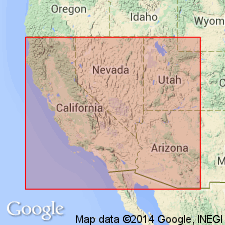
Pg. 540-541. Gila conglomerate. A system of valley beds, of which a conglomerate is the characteristic member, which are exhibited in section along the gorges of the upper Gila and its tributaries, the Bonita, Prieto, Gilita, and San Francisco creeks and rivers. The boulders of the conglomerate are of local origin; the cement is calcareous; interbedded by layers of slightly coherent sand, and of trass [nonwelded massive ash- and pumice-flow deposits (Glossary of geology def.)], and sheets of basalt, the latter in some cliffs predominating over the conglomerate. Thickness 1,000 to 1,500+/- feet. Recognized in Arizona and southwestern New Mexico. Age is Pliocene and Pleistocene.
Source: US geologic names lexicon (USGS Bull. 896, p. 817).
- Usage in publication:
-
- Gila conglomerate*
- Modifications:
-
- Age modified
- Dominant lithology:
-
- Conglomerate
- AAPG geologic province:
-
- Basin-and-Range province
Summary:
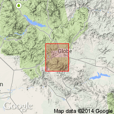
Gila conglomerate. Extended into Globe district, Arizona. Valley deposit 1,000 feet thick. Pebble and boulder conglomerate of chiefly schist or granite and lesser dacite, diabase, and quartz, derived from adjacent mountains. Age is early Pleistocene (Pleistocene? on accompanying geologic map); Gilbert (1875) reported age of Pliocene and Pleistocene.
Source: Modified from GNU records (USGS DDS-6; Denver GNULEX).
- Usage in publication:
-
- Gila conglomerate
- Modifications:
-
- Revised
- AAPG geologic province:
-
- Basin-and-Range province
Wood, P.A., 1960, [Title unknown]: Arizona Geological Society Guidebook, no. 2, p. __.
Summary:
Pg. 60. Three units distinguished in Gila conglomerate in Safford Valley area, Arizona. Bonita beds (lowest), Solomonsville beds, and Frye Mesa beds. Pliocene and Pleistocene. [Names credited to W.L. Van Horn and L.A. Heindl (unpub. theses).]
Source: US geologic names lexicon (USGS Bull. 1200, p. 1503).
- Usage in publication:
-
- Gila group*
- Modifications:
-
- Revised
- Age modified
- AAPG geologic province:
-
- Basin-and-Range province
Summary:
Name has been applied in AZ to alluvial deposits that are lithologically and texturally similar and that are physically continuous. Rank raised and divided in report area (Basin-and-Range province) into three newly named formations: San Manuel formation (base), Quiburis formation, and Sacaton formation (top). Inclusion of San Manuel may be questionable because it may have been deposited prior to the formation of the present San Pedro Valley; however, the San Manuel meets all the other criteria of the group--it was derived from the nearby mountains and is in depositional contact with the mountains. Sacaton was deposited in a valley entrenched into the Quiburis. Sacaton included in group because it was derived from the adjacent mountains and because it was laid down before the last period of degradation. Of the three formations, only the Quiburis is a classical basin-fill deposit. Age is changed from Pliocene and Pleistocene to Tertiary and Quaternary, probably middle? Tertiary to early Pleistocene. Geologic map. Nomenclature chart.
Source: GNU records (USGS DDS-6; Denver GNULEX).
- Usage in publication:
-
- Gila Conglomerate*
- Gila Group*
- Modifications:
-
- Not used
Summary:
Gila Conglomerate or Gila Group. Geographically restricted from the Ray-San Manuel area, eastern Pinal County, Arizona (Basin-and-Range province). Heindl's (1963, USGS Bull. 1141-E) San Manuel and Quiburis Formations are removed from Gila Group, and his †Sacaton Formation is abandoned, thus removing Gila from group rank anywhere. Recent mapping and K-Ar ages show that Heindl's three formations were deposited in basins that developed at different times and not during development of one large structural basin as previously thought. Report includes correlation chart.
Source: Publication; Changes in stratigraphic nomenclature, 1972 (USGS Bull. 1394-A, p. A17); supplemental information from GNU records (USGS DDS-6; Denver GNULEX).
- Usage in publication:
-
- Gila Conglomerate*
- Modifications:
-
- Age modified
- Geochronologic dating
- AAPG geologic province:
-
- Basin-and-Range province
Summary:
Eastern limit of formation on geologic map is above Mimbres River and in canyons in northwest part of San Lorenzo quad, Grant Co, NM, Basin-and-Range province. Age in San Lorenzo quad given as Pliocene?, Miocene, and Miocene?. Basalt near top of formation dated as 6.29 Ma (whole-rock K-Ar age). North of area, lower part of formation intertongues with basalt dated as 20 Ma.
Source: GNU records (USGS DDS-6; Denver GNULEX).
- Usage in publication:
-
- Gila Conglomerate*
- Modifications:
-
- Age modified
- AAPG geologic province:
-
- Basin-and-Range province
Summary:
Age given on geologic map as Miocene, Pliocene, and Pleistocene. [This age accepted by GNC as age of formation in Grant Co, NM in Basin-and-Range province].
Source: GNU records (USGS DDS-6; Denver GNULEX).
- Usage in publication:
-
- Gila Conglomerate*
- Modifications:
-
- Age modified
- AAPG geologic province:
-
- Basin-and-Range province
Summary:
Assigned an age of Pleistocene, Pliocene?, Miocene, and Oligocene? in this quad. Basalt flows less than 3 m.y. old are interlayered in Gila in adjoining Luna quad [adjacent and to north of this quad]. A one 1 m.y. old basalt interlayered in conglomerate in Squirrel Springs Canyon quad nearby. Overlies Bearwallow Mountain Formation which may be Miocene and (or) Oligocene. Mapped in southeast part and in extreme northeast part of quad, Catron Co, NM in the Basin-and-Range province.
Source: GNU records (USGS DDS-6; Denver GNULEX).
- Usage in publication:
-
- Gila Formation*
- Modifications:
-
- Geochronologic dating
- Mapped 1:24k
- Paleomagnetics
- Dominant lithology:
-
- Conglomerate
- Sandstone
- Basalt
- AAPG geologic province:
-
- Basin-and-Range province
Summary:
Mapped over much of quad, except in southwest part. Study area is in southwest NM, Basin-and-Range province in the northwestern part of Mogollon-Datil volcanic field in transition zone between Colorado Plateau and Basin-and-Range physiographic provinces. Gila consists of basin-filling sedimentary rocks which include volcaniclastic conglomerate, sandstone, siltstone, as well as interlayered basaltic to dacitic lava flows and associated intrusions. [Because of this mixed lithology, rank term "Formation" is used.] Youngest dated volcanic rocks are basalt on Flat Top Mesa (9.39 Ma) and dacite of Eagle Peak (11.4-12.1 Ma). Sedimentary rocks are divided into post-Eagle Peak (upper part of Gila) and pre-Eagle Peak (lower part of Gila). Where interlayered volcanic rocks are absent in the Gila, sedimentary rocks are mapped as undivided Gila. Not likely that any of Gila is Quaternary age in this quad. Maximum thickness of sedimentary rocks is 200 m. Younger than Bearwallow Mountain Andesite; underlies Quaternary surficial rocks. Geochemistry (table 1); 40Ar/39Ar ages (table 2) paleomagnetic data (table 3). Assigned Miocene to Pliocene? age.
Source: GNU records (USGS DDS-6; Denver GNULEX).
For more information, please contact Nancy Stamm, Geologic Names Committee Secretary.
Asterisk (*) indicates published by U.S. Geological Survey authors.
"No current usage" (†) implies that a name has been abandoned or has fallen into disuse. Former usage and, if known, replacement name given in parentheses ( ).
Slash (/) indicates name conflicts with nomenclatural guidelines (CSN, 1933; ACSN, 1961, 1970; NACSN, 1983, 2005, 2021). May be explained within brackets ([ ]).