The National Geologic Map Database is migrating to a new infrastructure. We apologize for any service disruptions during this process.
|
|---|


- Usage in publication:
-
- Gibson limestone member
- Modifications:
-
- Original reference
- Dominant lithology:
-
- Limestone
- AAPG geologic province:
-
- Strawn basin
Summary:
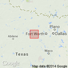
Pg. 22, 25 (fig. 16) [H.T. Mann, Geologic map of Barton Creek area, Erath County, Texas]. Gibson limestone member of Grindstone Creek limestone of Millsap Lake group. Name applied to member of Grindstone Creek [name credited to H.T. Mann, Univ. Texas, unpub. MS thesis]. Lies below Goen limestone and above Santo limestone member. Unit had been mapped as Santo(?) by Plummer and Hornberger (Univ. Texas Bull., no. 3534, 1936) and as Goen by Nickell (Univ. Texas Bur. Econ. Geol. Min. Res. Survey Circular, no. 26, 1939). Age is Middle Pennsylvanian.
Named from exposures along Gibson Creek, Erath Co., north-central TX.
Source: US geologic names lexicon (USGS Bull. 1200, p. 1503).
For more information, please contact Nancy Stamm, Geologic Names Committee Secretary.
Asterisk (*) indicates published by U.S. Geological Survey authors.
"No current usage" (†) implies that a name has been abandoned or has fallen into disuse. Former usage and, if known, replacement name given in parentheses ( ).
Slash (/) indicates name conflicts with nomenclatural guidelines (CSN, 1933; ACSN, 1961, 1970; NACSN, 1983, 2005, 2021). May be explained within brackets ([ ]).