The National Geologic Map Database is migrating to a new infrastructure. We apologize for any service disruptions during this process.
|
|---|


- Usage in publication:
-
- Geuda salt measures
- Modifications:
-
- Original reference
- Dominant lithology:
-
- Shale
- Gypsum
- Limestone
- Salt
- AAPG geologic province:
-
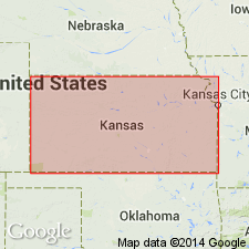
- Sedgwick basin
Summary:
Geuda salt measures. Chiefly clay shales, of many colors and kinds, and beds of limestone, gypsum, and salt. Thickness 300 to 400 feet. Divided into (descending): (1) shale and shaly limestone; (2) Greeley gypsum; (3) shales, 100 feet; (4) Hope gypsum. Basal formation of Sumner division. Underlies Wellington shales and overlies Marion concretionary limestone (top bed of Chase limestones in Flint Hills division). Prosser's term Marion formation included Geuda salt measures and lower part of Wellington and is preoccupied. Fossiliferous (lamellibranchs, brachiopods, bivalves, tracks, etc.). Age is Permian.
Named from town of Geuda Springs, [Sumner Co.], eastern KS.
Source: US geologic names lexicon (USGS Bull. 896, p. 816); GNC KS-NE Permian Corr. Chart, Oct. 1936; supplemental information from GNU records (USGS DDS-6; Denver GNULEX).

- Usage in publication:
-
- Geuda salt measures†
- Modifications:
-
- Abandoned
- AAPG geologic province:
-
- Sedgwick basin
Summary:
†Geuda salt measures in Sumner Group. Cragin later [post-1896] abandoned this name for Marion formation. The latter name has been used to include the salt beds and also to exclude them. In 1927 the Kansas Geol. Survey and USGS abandoned Marion formation and redefined Wellington formation so as to extend down to top of Herington limestone. The salt beds are therefore now included in the Wellington.
Source: US geologic names lexicon (USGS Bull. 896, p. 816); GNC KS-NE Permian Corr. Chart, Oct. 1936.
For more information, please contact Nancy Stamm, Geologic Names Committee Secretary.
Asterisk (*) indicates published by U.S. Geological Survey authors.
"No current usage" (†) implies that a name has been abandoned or has fallen into disuse. Former usage and, if known, replacement name given in parentheses ( ).
Slash (/) indicates name conflicts with nomenclatural guidelines (CSN, 1933; ACSN, 1961, 1970; NACSN, 1983, 2005, 2021). May be explained within brackets ([ ]).