The National Geologic Map Database is migrating to a new infrastructure. We apologize for any service disruptions during this process.
|
|---|


- Usage in publication:
-
- Gettysburg shale
- Modifications:
-
- Original reference
- Dominant lithology:
-
- Shale
- Sandstone
- AAPG geologic province:
-
- Piedmont-Blue Ridge province
- Gettysburg basin
Summary:
New Holland sheet, A.I Jonas, p. 17. Gettysburg shale is second and middle member of the Triassic. Is composed of soft, red, shaly sandstones with hard gray pebbly sandstone beds, and contains beds of thick red sandstone with scattered pebbles of different sizes. It is here made up of less shale and more sandstone than in type area, and is overlain by an undetermined thickness of coarse conglomerate interbedded with red sandstone, which forms upper member of Triassic. Thickness of Gettysburg shale is about 1,000 feet. [On accompanying map it is mapped as "soft red shale and sandstone."] It rests on "basal member of Triassic" (called lower arkosic sandstone and conglomerate member), which consists of 1,000 feet of quartz conglomerate underlain by about 500 feet of arkosic red sandstone.
[Named from exposures at Gettysburg, Adams Co., southern PA.]
Source: US geologic names lexicon (USGS Bull. 896, p. 816).
- Usage in publication:
-
- Gettysburg shale*
- Modifications:
-
- Principal reference
- Revised
- Dominant lithology:
-
- Argillite
- Sandstone
- Conglomerate
- AAPG geologic province:
-
- Piedmont-Blue Ridge province
- Gettysburg basin
Summary:
Gettysburg shale of Newark group. Gettysburg shale is redefined so as to include all Triassic sediments of this part of southeastern Pennsylvania that overlie New Oxford formation (lower formation of Newark group). These Gettysburg sediments, which compose upper formation of Newark group in this region aggregate approximately 16,000 feet, and consist in general of red shales and soft red sandstones, with minor amounts of white sandstone, green and yellow shale, black carbonaceous shale, and dark impure limestone. Much of formation has been metamorphosed, by intrusive diabase, to dark purple or black argillite or to white porcelanite. Near middle is Heidlersburg member and at top the Arendtsville fanglomerate member (consisting of quartzose conglomerate) and a contemporaneous is conglomerate. [Age is Late Triassic.]
[Type section (composite): measured sections in and around Gettysburg, Gettysburg 7.5-min quadrangle, Adams Co., central southern PA.]
Source: US geologic names lexicon (USGS Bull. 896, p. 816); supplemental information from GNU records (USGS DDS-6; Reston GNULEX).
- Usage in publication:
-
- Gettysburg shale
- Modifications:
-
- Revised
- AAPG geologic province:
-
- Newark basin
Summary:
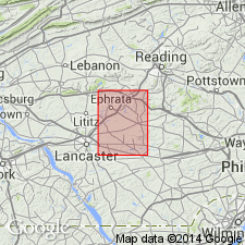
The Elizabeth Furnace conglomerate member in the lower part of the Gettysburg shale is described at Hammer Creek in the Lancaster quadrangle, PA.
Source: GNU records (USGS DDS-6; Reston GNULEX).
- Usage in publication:
-
- Gettysburg shale*
- Modifications:
-
- Areal extent
- AAPG geologic province:
-
- Newark basin
Summary:
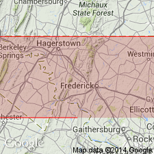
The Gettysburg shale of the Newark group is geographically extended into the Triassic basin in Frederick Co., MD, in the area of Emmitsburg and Thurmont.
Source: GNU records (USGS DDS-6; Reston GNULEX).
- Usage in publication:
-
- Gettysburg shale*
- Modifications:
-
- Revised
- AAPG geologic province:
-
- Piedmont-Blue Ridge province
- Gettysburg basin
Summary:
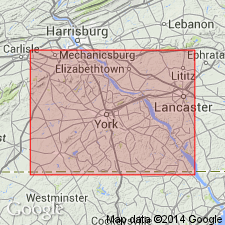
In York County the Gettysburg shale consists of a basal lenticular zone of red arkosic sandstone and conglomerate here named the Conewago conglomerate member, a zone of hard gray and red sandstone called the Heidlersburg member near the middle, and beds of limestone conglomerate and quartzose fanglomerate at the top, including the Arendtsville fanglomerate lentil.
Source: GNU records (USGS DDS-6; Reston GNULEX).
- Usage in publication:
-
- Gettysburg lithofacies
- Modifications:
-
- Revised
- AAPG geologic province:
-
- Newark basin
Summary:
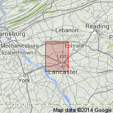
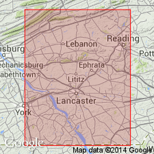
The Gettysburg is termed a sandstone lithofacies in the area of Lebanon and Lancaster Counties where the Triassic basin reaches a minimum width of 4 mi. It here includes the Furnace Ridge conglomerate member near the base. A section at Hammer Creek in the Lancaster quad. is described.
Source: GNU records (USGS DDS-6; Reston GNULEX).
- Usage in publication:
-
- Gettysburg Formation
- Modifications:
-
- Revised
- AAPG geologic province:
-
- Newark basin
Summary:
Coarse sediments exposed in the narrow neck of the Newark-Gettysburg basin in PA, typical of neither the Gettysburg nor the Brunswick Formations, are named the Hammer Creek Formation, which is defined by two arbitrary cut-offs. The Gettysburg-Hammer Creek boundary is arbitrarily drawn at the Dauphin-Lebanon Co. line east of the Susquehanna River, and the Brunswick-Hammer Creek boundary at a line in the vicinity of the Schuylkill River. Previously the boundary between the Gettysburg and the Brunswick was defined as a NW-trending irregularly shaped diabase body in the Morgantown and Terre Hill quads., Lancaster Co. The Gettysburg here includes the Heidlersburg and Arendtsville members. The Conewago Conglomerate Member is not recognized and its rocks are assigned to the lower unnamed member of the Gettysburg. The Elizabeth Furnace and Furnace Ridge Members, in the area of the Hammer Creek Formation, are not recognized.
Source: GNU records (USGS DDS-6; Reston GNULEX).
- Usage in publication:
-
- Gettysburg Formation
- Modifications:
-
- Biostratigraphic dating
- AAPG geologic province:
-
- Newark basin
Summary:
The age of the Gettysburg Formation is late Carnian and Norian to Early Jurassic. The Aspers basalt flow in the upper Gettysburg is overlain by 230 m (750 ft) of strata dated by palynomorphs as Early Jurassic.
Source: GNU records (USGS DDS-6; Reston GNULEX).
- Usage in publication:
-
- Gettysburg Formation*
- Modifications:
-
- Biostratigraphic dating
- AAPG geologic province:
-
- Piedmont-Blue Ridge province
Summary:
A new palynomorph species, FROELICHSPORITES TRAVERSEI, occurs throughout Newark Supergroup of eastern United States and Canada, Dockum Group of TX and NM, and Chinle Formation of NM, AZ, and UT. It is restricted geologically to strata deposited during upper Carnian and Norian Stages of the Upper Triassic. It occurs in the following formations of the Newark Supergroup: Passaic Formation (NJ), Gettysburg Formation (PA and MD), Manassas Sandstone (MD), Balls Bluff Siltstone (VA), Cow Branch Formation (NC), and Stoneville Formation (NC).
Source: GNU records (USGS DDS-6; Reston GNULEX).
For more information, please contact Nancy Stamm, Geologic Names Committee Secretary.
Asterisk (*) indicates published by U.S. Geological Survey authors.
"No current usage" (†) implies that a name has been abandoned or has fallen into disuse. Former usage and, if known, replacement name given in parentheses ( ).
Slash (/) indicates name conflicts with nomenclatural guidelines (CSN, 1933; ACSN, 1961, 1970; NACSN, 1983, 2005, 2021). May be explained within brackets ([ ]).