- Usage in publication:
-
- Gervais Formation
- Modifications:
-
- Original reference
- Dominant lithology:
-
- Silt
- Clay
- Sand
- AAPG geologic province:
-
- Sioux uplift
- Williston basin
Summary:
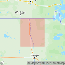
Pg. 5 (fig. 2), 6-9, 28-30 (measured sections). Gervais Formation. Unbedded, gray to reddish brown, silty, very slightly pebbly clay-loam. Contains a few cobbles near top. Sand lenses, a few mm thick, are present with increasing abundance upward. Thickness 40+ feet; base not observed and its nature is unknown. Overlain by Marcoux Formation (new) at type section, and Red Lake Falls Formation (new) at reference section. Only known exposures in Red Lake Falls area, Minnesota (type area). Interpreted as glacially modified fluvial or lacustrine sediments. Abundant fossils (wood, mollusks, insects, green moss) in lower part. Radiocarbon age of 39,000+ yr B.P. obtained from a log near base of type section. (Organic material from a possible correlative subsurface silt and sand unit near Lake Bronson, Minnesota, yielded radiocarbon ages of 19,000+ to 38,000+ yr B.P.) Age is considered late Pleistocene (early Wisconsinan or pre-Wisconsinan).
Type section: Three Creeks section, left bank of Red Lake River, Red Lake Falls area, in NE/4 NE/4 NW/4 sec. 21, T. 151 N., R. 44 W., Red Lake Falls 15-min quadrangle, Red Lake Co., northwestern MN.
Reference section: Moo Point section, Red Lake Falls area, in NE/4 NE/4 NW/4 sec. 19, T. 151 N., R. 44 W., Red Lake Falls 15-min quadrangle, Red Lake Co., northwestern MN.
Named from Gervais Twp., Red Lake Co., northwestern MN.
Source: Publication.
For more information, please contact Nancy Stamm, Geologic Names Committee Secretary.
Asterisk (*) indicates published by U.S. Geological Survey authors.
"No current usage" (†) implies that a name has been abandoned or has fallen into disuse. Former usage and, if known, replacement name given in parentheses ( ).
Slash (/) indicates name conflicts with nomenclatural guidelines (CSN, 1933; ACSN, 1961, 1970; NACSN, 1983, 2005, 2021). May be explained within brackets ([ ]).

