

- Usage in publication:
-
- Gerlane formation
- Modifications:
-
- Original reference
- Dominant lithology:
-
- Alluvium
- AAPG geologic province:
-
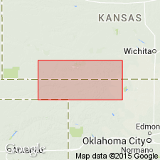
- Sedgwick basin
Summary:
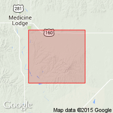
Pg. 91. Gerlane formation. A Quaternary continental deposit of south-central Kansas, with type locality near Gerlane, Barber County. Is of alluvial origin; derived from Permian and Tertiary formations in the area. Occurs both as valley filling and as surface wash, the former type best developed in larger valleys, giving them smooth broad floors. Where partly removed by erosion the Gerlane forms terrace along valley sides. The surface-wash phase covers much of intervalley areas of lower slopes. Thickness 100+ feet in drills near Sharon, in what is believed to have been valley of Medicine Lodge River before it changed its course.
Source: US geologic names lexicon (USGS Bull. 896, p. 814).
- Usage in publication:
-
- Gerlane formation
- Modifications:
-
- Areal extent
- AAPG geologic province:
-
- Sedgwick basin
Summary:
Pg. 91-92. Term Gerlane formation has been applied to Pleistocene beds only in Barber County, south-central Kansas. These deposits underlie floor of lowland surface that extends westward as far as eastern Meade County; topographically below Tertiary-capped upland to north. Deposits similar to the Gerlane occur in Clark County and eastern Meade County, Kansas, and in Beaver and Harper Counties, Oklahoma. These deposits, loosely referred to as Ashland-Englewood terrace beds, are shown by the physiographic relations and fauna to be late Pleistocene in age, but their exact correlation with named formations in Meade basin and elsewhere in central and western Kansas is unknown. Age and stratigraphic relations of Gerlane formation and associated beds are problems for further study.
Source: US geologic names lexicon (USGS Bull. 1200, p. 1497-1498).
- Usage in publication:
-
- Gerlane formation†
- Modifications:
-
- Abandoned
- AAPG geologic province:
-
- Sedgwick basin
Summary:
Pg. 110. †Gerlane formation. Name appears in list in units that consist in part or entirely of deposits known to be of Illinoian or younger age and that are properly classed, at least in part, as Sanborn formation.
Source: US geologic names lexicon (USGS Bull. 1200, p. 1497-1498).
For more information, please contact Nancy Stamm, Geologic Names Committee Secretary.
Asterisk (*) indicates published by U.S. Geological Survey authors.
"No current usage" (†) implies that a name has been abandoned or has fallen into disuse. Former usage and, if known, replacement name given in parentheses ( ).
Slash (/) indicates name conflicts with nomenclatural guidelines (CSN, 1933; ACSN, 1961, 1970; NACSN, 1983, 2005, 2021). May be explained within brackets ([ ]).