The National Geologic Map Database is migrating to a new infrastructure. We apologize for any service disruptions during this process.
|
|---|


- Usage in publication:
-
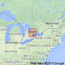
- Georgian Bay Formation
- Modifications:
-
- Named
- Dominant lithology:
-
- Limestone
- Shale
Summary:
Gray carbonate beds and blue and gray shale in the Lake Simcoe district, Ontario, are here named the Georgian Bay Formation of the Nottawasaga Group. Lower and upper informal members comprise the combined strata of the biostratigraphic Dundas and Meaford units. Overlies the Whitby Formation; underlies the Queenston Formation. Thickness is 130 m. Age is Late Ordovician (Cincinnatian).
Source: GNU records (USGS DDS-6; Reston GNULEX).
- Usage in publication:
-
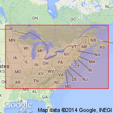
- Georgian Bay Formation
- Modifications:
-
- Principal reference
- AAPG geologic province:
-
- Michigan basin
Summary:
Georgian Bay Formation is geographically extended to Drummond Island, Chippewa Co., MI, where a lectotype section is designated.
Source: GNU records (USGS DDS-6; Reston GNULEX).
For more information, please contact Nancy Stamm, Geologic Names Committee Secretary.
Asterisk (*) indicates published by U.S. Geological Survey authors.
"No current usage" (†) implies that a name has been abandoned or has fallen into disuse. Former usage and, if known, replacement name given in parentheses ( ).
Slash (/) indicates name conflicts with nomenclatural guidelines (CSN, 1933; ACSN, 1961, 1970; NACSN, 1983, 2005, 2021). May be explained within brackets ([ ]).