The National Geologic Map Database is migrating to a new infrastructure. We apologize for any service disruptions during this process.
|
|---|


- Usage in publication:
-
- Georgia group
- Georgia slate
- Modifications:
-
- Original reference
- Dominant lithology:
-
- Slate
- Limestone
- Conglomerate
- AAPG geologic province:
-
- New England province
Summary:
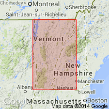
E. Hitchcock, v. 1, p. 357-386. Georgia group or Georgia slate. Consists of clay slate; roofing slate; clay slate approximating to micaceous sandstone; various kinds of limestone; brecciated limestone; and conglomerate composed of pebbles of limestone. Includes what Professor [E.] Emmons has called black slate; in part, Taconic slate, and roofing slate. Age in doubt. Thickness 2,000 feet. Overlain by Talcose conglomerate; is younger than the Quartz Rock, which has been mistaken for Potsdam sandstone, and the Red Sandrock series. The Georgia slate is fully exposed in town of Georgia [Milton quadrangle], Franklin County, northwestern Vermont, where its most interesting fossils have been found.
Source: US geologic names lexicon (USGS Bull. 896, p. 813-814).

- Usage in publication:
-
- Georgia slate*
- Modifications:
-
- Age modified
- Biostratigraphic dating
- AAPG geologic province:
-
- New England province
Summary:
Assigned an Early Ordovician age to the Georgia slate in VT based on fossils correlated to the Beekmantown.
Source: GNU records (USGS DDS-6; Reston GNULEX).
For more information, please contact Nancy Stamm, Geologic Names Committee Secretary.
Asterisk (*) indicates published by U.S. Geological Survey authors.
"No current usage" (†) implies that a name has been abandoned or has fallen into disuse. Former usage and, if known, replacement name given in parentheses ( ).
Slash (/) indicates name conflicts with nomenclatural guidelines (CSN, 1933; ACSN, 1961, 1970; NACSN, 1983, 2005, 2021). May be explained within brackets ([ ]).