The National Geologic Map Database is migrating to a new infrastructure. We apologize for any service disruptions during this process.
|
|---|


- Usage in publication:
-
- Georgetown Limestone*
- Modifications:
-
- Mapped 1:62.5k
- Dominant lithology:
-
- Limestone
- AAPG geologic province:
-
- Permian basin
Summary:
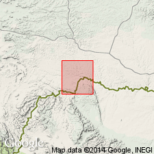
Is formation mapped in eastern Brewster and southwest Terrell Cos, TX in Permian basin. Overlies Kiamichi? Formation; underlies Grayson Formation. Map unit described as light-gray to light olive-gray, thin- to very thick-bedded limestone and dolomitic limestone mostly very finely to finely crystalline, a few beds near top of unit not visibly crystalline; fossiliferous; contains gray to reddish-brown chert as nodules, sheets along bedding planes, and replaced fossils. Weathering produces medium-gray to grayish-orange coating that is more resistant and less porous than unweathered rock; solution openings and rillenstein common. Thickness 450 to 600 ft. Age is Early Cretaceous.
Source: GNU records (USGS DDS-6; Denver GNULEX).

- Usage in publication:
-
- Georgetown Formation
- Modifications:
-
- Areal extent
- Dominant lithology:
-
- Limestone
- Shale
- AAPG geologic province:
-
- Ouachita folded belt
Summary:
Georgetown Formation. Limestone with some shale; limestone mostly fine-grained, argillaceous, nodular, moderately indurated, light gray; shale, calcareous, soft, light gray to yellowish gray. Thickness 10 to 45 feet. Overlies Edwards Limestone (Lower Cretaceous); underlies Del Rio Clay (Lower Cretaceous). Age is Early Cretaceous.
Not separately mapped. [Present in Hays Co., southeastern TX.]
Source: Modified from GNU records (USGS DDS-6; Denver GNULEX).
For more information, please contact Nancy Stamm, Geologic Names Committee Secretary.
Asterisk (*) indicates published by U.S. Geological Survey authors.
"No current usage" (†) implies that a name has been abandoned or has fallen into disuse. Former usage and, if known, replacement name given in parentheses ( ).
Slash (/) indicates name conflicts with nomenclatural guidelines (CSN, 1933; ACSN, 1961, 1970; NACSN, 1983, 2005, 2021). May be explained within brackets ([ ]).