The National Geologic Map Database is migrating to a new infrastructure. We apologize for any service disruptions during this process.
|
|---|


- Usage in publication:
-
- Georgetown complex
- Modifications:
-
- Named
- Dominant lithology:
-
- Gabbro
- Diorite
- Quartz diorite
- AAPG geologic province:
-
- Piedmont-Blue Ridge province
Summary:
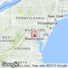
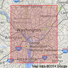
Name given to poorly exposed complex of ultramafic, gabbroic, dioritic, and dark quartz dioritic rocks that underlie a large part of Washington, D.C., and adjacent parts of Montgomery Co., MD. Age is early Paleozoic.
Source: GNU records (USGS DDS-6; Reston GNULEX).
- Usage in publication:
-
- Georgetown complex
- Modifications:
-
- Age modified
- AAPG geologic province:
-
- Piedmont-Blue Ridge province
Summary:
Briefly described as large body of igneous rocks ranging from tonalite to granite. Age of Piedmont rocks in DC area in dispute. Recent work suggests very late Proterozoic or early Paleozoic age
Source: GNU records (USGS DDS-6; Reston GNULEX).

- Usage in publication:
-
- Georgetown Intrusive Suite
- Modifications:
-
- Overview
- AAPG geologic province:
-
- Piedmont-Blue Ridge province
Summary:
Georgetown Intrusive Suite used on VA State map. Description from Flemming and others (in press). Cambrian age indicated by map symbol.
Source: GNU records (USGS DDS-6; Reston GNULEX).
- Usage in publication:
-
- Georgetown Intrusive Suite*
- Modifications:
-
- Age modified
- Geochronologic dating
- AAPG geologic province:
-
- Piedmont-Blue Ridge province
Summary:
Hornblende tonalite of the Georgetown Intrusive Suite yielded U-Pb date of 465+/-5 Ma (Early Ordovician).
Source: GNU records (USGS DDS-6; Reston GNULEX).
- Usage in publication:
-
- Georgetown Intrusive Suite*
- Modifications:
-
- Overview
- AAPG geologic province:
-
- Piedmont-Blue Ridge province
Summary:
The Georgetown Intrusive Suite is divided into six mappable units in the map area and consists of a biotite tonalite, garnetiferous biotite-hornblende tonalite, biotite-hornblende tonalite, quartz gabbro and quartz diorite, metapyroxenite and hornblendite, and serpentinite and talc schist. The Georgetown is predominantly made up of the mafic biotite-hornblende tonalite, and the quartz gabbro and biotite tonalite make up smaller plutons. Possibly five intrusive phases can be identified within this intrusive suite that intrudes surrounding metasedimentary rocks. The Georgetown Intrusive Suite is of Early Ordovician age.
Source: GNU records (USGS DDS-6; Reston GNULEX).
- Usage in publication:
-
- Georgetown Intrusive Suite*
- Modifications:
-
- Revised
- Age modified
- Areal extent
- AAPG geologic province:
-
- Piedmont-Blue Ridge province
Summary:
Georgetown Complex of Hopson (1964) is here revised as Georgetown Intrusive Suite because it consists of rocks of only one genetic class (igneous) (North American Commission on Stratigraphic Nomenclature, 1983, art. 36,37). Unit is extended to VA. Rocks are intruded by Kensington Tonalite (revised). The Georgetown is of Early Ordovician age.
Source: GNU records (USGS DDS-6; Reston GNULEX).
For more information, please contact Nancy Stamm, Geologic Names Committee Secretary.
Asterisk (*) indicates published by U.S. Geological Survey authors.
"No current usage" (†) implies that a name has been abandoned or has fallen into disuse. Former usage and, if known, replacement name given in parentheses ( ).
Slash (/) indicates name conflicts with nomenclatural guidelines (CSN, 1933; ACSN, 1961, 1970; NACSN, 1983, 2005, 2021). May be explained within brackets ([ ]).