- Usage in publication:
-
- Gateway Pass unit*
- Modifications:
-
- Principal reference
- Dominant lithology:
-
- Limestone
- Dolomite
- AAPG geologic province:
-
- Sweetgrass arch
Summary:
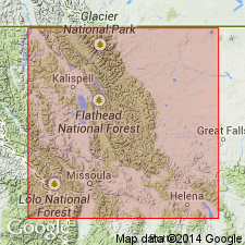
Named as a basal informal unit of the Mississippian Castle Reef Formation (revised; redefined) in the Sweetgrass arch. Principal reference section is at North Fork Dupuyer Creek, NW1/4 NW1/4 SW1/4 sec 21, T27N, R9W, Walling Reef quad. Named for Gateway Pass in Gateway Pass quad in SE1/4 sec 14, T27N, R11W. Is a white, thick to massively bedded cross-bedded crinoidal grainstone, wackestone, and packstone. Varies from 35 to 75 m thick. Is 58 m thick at Gateway Pass. Overlies Allan Mountain Formation (redefined; revised). Underlies Dupuyer Creek unit (named) of Castle Reef Formation (redefined; revised). Origin suggested as a subaqueous dune-field deposit.
Source: GNU records (USGS DDS-6; Denver GNULEX).
For more information, please contact Nancy Stamm, Geologic Names Committee Secretary.
Asterisk (*) indicates published by U.S. Geological Survey authors.
"No current usage" (†) implies that a name has been abandoned or has fallen into disuse. Former usage and, if known, replacement name given in parentheses ( ).
Slash (/) indicates name conflicts with nomenclatural guidelines (CSN, 1933; ACSN, 1961, 1970; NACSN, 1983, 2005, 2021). May be explained within brackets ([ ]).

