The National Geologic Map Database is migrating to a new infrastructure. We apologize for any service disruptions during this process.
|
|---|


- Usage in publication:
-
- Gates limestone
- Modifications:
-
- Named
- Areal extent
- Dominant lithology:
-
- Limestone
- AAPG geologic province:
-
- Appalachian basin
Summary:
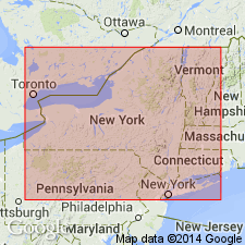
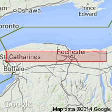
Name Gates limestone applied to 20 ft of beds at Rochester, heretofore included in Rochester shale. Beds are apparently absent at Niagara, and are actually limestone, rather than shale. Unconformably underlies DeCew (basal member of Lockport dolomite; separated from Rochester shale below by a perfectly clean-cut line or clay seam. Contains few fossils except LINGULA LAMELLATA. Named for town in Monroe Co. in which the beds appear in the canal prism. Probably continues to thicken east of Rochester under the drift and is very likely the rock forming the falls at Wolcott village. Present at Ontario, NY, and at Wallington and probably at Red Creek in Wayne Co. Doubtfully identified at South Granby and Brewerton, NY, and at Hamilton, Ontario. Absent in Lakeport well, Madison Co. Age is Silurian.
Source: GNU records (USGS DDS-6; Reston GNULEX).
- Usage in publication:
-
- Gates
- Modifications:
-
- Not used
- AAPG geologic province:
-
- Appalachian basin
Summary:
Term Gates, in sense proposed by Chadwick, is a formation, for he says it is separated from the Rochester below. Gates is a rock facies, and the retention of the name as a formation or a member of the Rochester is deemed inadvisable.
Source: GNU records (USGS DDS-6; Reston GNULEX).

- Usage in publication:
-
- Gates Dolomite
- Modifications:
-
- Revised
- AAPG geologic province:
-
- Appalachian basin
Summary:
Unit referred to as Gates Dolomite and assigned to the Clinton Group in this NY State publication. Age given as Late Silurian.
Source: GNU records (USGS DDS-6; Reston GNULEX).

- Usage in publication:
-
- Gates Member
- Modifications:
-
- Revised
- AAPG geologic province:
-
- Appalachian basin
Summary:
Gates used at Member rank in this report and assigned to top of the Rochester Shale of Clinton Group in Monroe Co, NY. Thickness at type locality along the Erie Barge Canal near Lyell Ave is 3 to 4 m. Unit is typically thick-bedded, buff-weathering, laminated clayey dolostone, with numerous small burrows (Chondrites). Underlies DeCew Dolomite of Lockport Group. Grades laterally into Burleigh Hill Member of Rochester.
Source: GNU records (USGS DDS-6; Reston GNULEX).
- Usage in publication:
-
- Gates Member
- Modifications:
-
- Overview
- AAPG geologic province:
-
- Appalachian basin
Summary:
Nomenclature follows Brett (1983). In the Rochester area, the very dolomitic shales of the Gates Member replace most of the Burleigh Hill Member and compose the upper third of the section. Underlies the Glenmark Bed, here assigned to the DeCew Formation.
Source: GNU records (USGS DDS-6; Reston GNULEX).
For more information, please contact Nancy Stamm, Geologic Names Committee Secretary.
Asterisk (*) indicates published by U.S. Geological Survey authors.
"No current usage" (†) implies that a name has been abandoned or has fallen into disuse. Former usage and, if known, replacement name given in parentheses ( ).
Slash (/) indicates name conflicts with nomenclatural guidelines (CSN, 1933; ACSN, 1961, 1970; NACSN, 1983, 2005, 2021). May be explained within brackets ([ ]).