The National Geologic Map Database is migrating to a new infrastructure. We apologize for any service disruptions during this process.
|
|---|


- Usage in publication:
-
- Garrisonville Mafic Complex
- Modifications:
-
- Overview
- AAPG geologic province:
-
- Piedmont-Blue Ridge province
Summary:
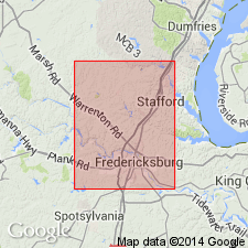
Garrisonville used as formal unit on VA State map. Mapped in Stafford Co. Name credited to Pavlides (1990). Described as fine- to coarse-grained, massive to foliated amphibolite and hornblendite with lesser metapyroxenite, metawebsterite, and metanorite. Amphiboles in amphibolite are dominantly hornblende. Plagioclase altered to clinozoisite or epidote. Quartz and chlorite present in variable amounts. Magnetite and ilmenite are common accessories. Hornblendite consists of coarse-grained hornblende in a groundmass of finer-grained hornblende, plagioclase, and quartz. Map symbol indicates Late Proterozoic and Cambrian age.
Source: GNU records (USGS DDS-6; Reston GNULEX).
- Usage in publication:
-
- Garrisonville Mafic Complex*
- Modifications:
-
- Named
- Dominant lithology:
-
- Amphibolite
- Hornblendite
- AAPG geologic province:
-
- Piedmont-Blue Ridge province
Summary:
[August, 11, 1995. Draft of map intended to be formally published as USGS I-map and to supersede U.S. Geological Survey Open-File Report OF-95-577, 2 sheets, scale 1:24,000.]
Garrison Mafic Complex named for Garrisonville, Stafford Co., northeastern VA. Type locality is along Aquia Creek in Stafford and Storck quads. Consists of massive to foliated amphibolite and hornblendite. Western part of complex contains metapyroxenite (clinopyroxene- and enstatite-bearing) and other altered rocks whose protoliths may have been websterite or norite. Talc-amphibole schist is present locally along western margin of complex. Intruded by plagiogranite of Richland Run pluton and by plagiogranite dikes (abundant along and near northern margin of complex). Contact between Garrisonville and Chopawamsic Formation is not exposed and it is not known whether contact in unconformable, or a fault, or even locally an intrusive contact. Age is not closely known, but is assigned a Late Proterozoic and (or) Early Cambrian age on the basis that it formed before Cambrian Chopawamsic Formation and is possibly a fragment of oceanic floor that formed in the back-arc terrane of Proterozoic time.
See U.S. Geological Survey Scientific Investigations Map SIM-2841, 1 sheet, scale 1:24,000, 2005 (http://ngmdb.usgs.gov/Prodesc/prodesc_81183.htm);
U.S. Geological Survey Miscellaneous Investigations Series Map I-2607, 2 sheets, scale 1:100,000, 2000 (http://ngmdb.usgs.gov/Prodesc/prodesc_32196.htm).
Source: Modified from GNU records (USGS DDS-6; Reston GNULEX).
For more information, please contact Nancy Stamm, Geologic Names Committee Secretary.
Asterisk (*) indicates published by U.S. Geological Survey authors.
"No current usage" (†) implies that a name has been abandoned or has fallen into disuse. Former usage and, if known, replacement name given in parentheses ( ).
Slash (/) indicates name conflicts with nomenclatural guidelines (CSN, 1933; ACSN, 1961, 1970; NACSN, 1983, 2005, 2021). May be explained within brackets ([ ]).