The National Geologic Map Database is migrating to a new infrastructure. We apologize for any service disruptions during this process.
|
|---|


- Usage in publication:
-
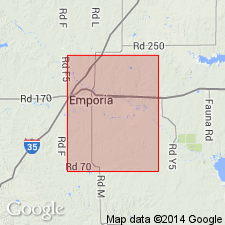
- Garrison formation
- Modifications:
-
- Original reference
- Dominant lithology:
-
- Shale
- Limestone
- AAPG geologic province:
-
- Nemaha anticline
Summary:
Pg. 712. Florena shales below (2 to 13 feet thick) and Neosho member above (130 feet thick), with aggregate thickness of 140 to 145 feet, are now united to form Garrison formation, so named on account of good exposures from Garrison south in Big Blue Valley. Included in Council Grove stage. Occurs above Cottonwood limestone and below Wreford limestone.
Named from exposures at Garrison, Pottawatomie Co., eastern KS.
[GNC remark (ca. 1936, US geologic names lexicon, USGS Bull. 896, p. 803): This name was continued in use for many years.]
Source: US geologic names lexicon (USGS Bull. 896, p. 803); GNC KS-NE Permian Corr. Chart, Oct. 1936.

- Usage in publication:
-
- Garrison shale
- Modifications:
-
- Revised
- AAPG geologic province:
-
- Nemaha anticline
- Forest City basin
Summary:
Garrison formation of Council Grove group. Includes (descending): Speiser shale restricted, Funston limestone, Blue Rapids shale, Crouse limestone, Easly Creek shale restricted, Middleburg limestone, Hooser shale, Eiss limestone, Stearns shale, Morrill limestone, and Florena shale members. Overlies Cottonwood limestone of Council Grove group; underlies Wreford [limestone] of Chase group. Recognized in southeastern Nebraska and eastern Kansas. Age is Permian (Big Blue).
Source: GNC KS-NE Permian Corr. Chart, Oct. 1936.

- Usage in publication:
-
- Garrison shale†
- Modifications:
-
- Abandoned
- AAPG geologic province:
-
- Nemaha anticline
- Forest City basin
Summary:
Pg. 50 (fig. 12). †Garrison shale of Council Grove group. In diagram showing comparison of old and revised classification of beds referred to lower part of Big Blue series of "Permian" age, Garrison shale is replaced with (ascending) Beattie limestone (includes Florena and Morrill limestone members), Stearns shale, Bader limestone (includes Eiss limestone, Hooser shale, and Middleburg limestone members), Easly Creek shale, Bigelow limestone (includes Crouse limestone, Blue Rapids shale, and Funston limestone members), and Speiser shale.
Source: US geologic names lexicon (USGS Bull. 1200, p. 1476); GNC KS-NE Permian Corr. Chart, Oct. 1936.

- Usage in publication:
-
- Garrison shale*
- Modifications:
-
- Overview
Summary:
Garrison shale of Council Grove group. In 1936 (Kansas Geol. Survey Bull., no. 22, p. 50, 251) R.C. Moore discarded the name, treating the numerous named subdivisions into which it had in recent years been differentiated as formations within Council Grove group. The USGS has not yet had occasion to reconsider retaining the name for its publications [ca. 1938].
Source: US geologic names lexicon (USGS Bull. 896, p. 803); GNC KS-NE Permian Corr. Chart, Oct. 1936.
- Usage in publication:
-
- Garrison shale
- Modifications:
-
- Areal extent
- AAPG geologic province:
-
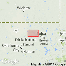
- Chautauqua platform
Summary:
Pg. 103-105. Garrison shale of Council Grove group. As used in this report, Garrison shale is top unit of Council Grove group. Includes beds upward from top of Cottonwood limestone to base of Wreford limestone. Name was discarded by Moore (1936) who raised various members of Garrison shale to formation rank. Formations constituting Garrison section in Kansas cannot be identified in Pawnee County, northern Oklahoma, and general term Garrison shale has been retained. Interval consists of poorly exposed heterogeneous sequence of red shales and red to tan lenticular sandstones. Thickness difficult to determine. About 140 feet in subsurface, slightly west of outcrop. Age is Permian.
Source: US geologic names lexicon (USGS Bull. 1200, p. 1476).
- Usage in publication:
-
- Garrison Shale
- Modifications:
-
- Areal extent
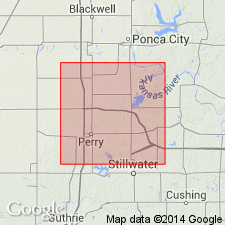
- AAPG geologic province:
-
- Chautauqua platform
Summary:
Pg. 6 (fig. 3), 7. Garrison Shale of Oscar Group. In Noble County, central northern Oklahoma, only uppermost part exposed in inliers in eastern part of T. 24 N., R. 3 E., beneath Wreford Limestone, and upper 30 feet exposed in T. 21 N., R. 3 E. Mostly red claystone. Age is Late Pennsylvanian (Gearyan); oldest formation exposed in county.
Source: Publication.
For more information, please contact Nancy Stamm, Geologic Names Committee Secretary.
Asterisk (*) indicates published by U.S. Geological Survey authors.
"No current usage" (†) implies that a name has been abandoned or has fallen into disuse. Former usage and, if known, replacement name given in parentheses ( ).
Slash (/) indicates name conflicts with nomenclatural guidelines (CSN, 1933; ACSN, 1961, 1970; NACSN, 1983, 2005, 2021). May be explained within brackets ([ ]).