The National Geologic Map Database is migrating to a new infrastructure. We apologize for any service disruptions during this process.
|
|---|


- Usage in publication:
-
- Garrison Schist, Formation
- Modifications:
-
- Named
- Dominant lithology:
-
- Schist
- Amphibolite
- Quartzite
- AAPG geologic province:
-
- Puget Sound province
Summary:
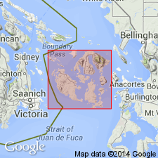
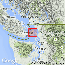
[Probably named for Garrison Bay]. Name credited to Danner (1966). Shown on map in area east of Garrison Bay, San Juan Island, San Juan Co, WA. Rock types are greenschist, amphibolite, and phyllitic quartzite in order of decreasing abundance. Forms discontinuous sheet-like body ranging up to 400 ft thick. Tectonically emplaced along contact between Permian cherts and Mesozoic clastic rocks. Initial deposition and metamorphism took place in interval, Silurian to Early Devonian.
Source: GNU records (USGS DDS-6; Menlo GNULEX).
- Usage in publication:
-
- Garrison Schist
- Modifications:
-
- Age modified
- Geochronologic dating
- AAPG geologic province:
-
- Puget Sound province
Summary:
Garrison Schist, referred to as part of Garrison terrane, is composed of high-pressure metamorphic rocks consisting of mafic schist with minor quartz-mica schist. Occurs only in small fault slices along Rosario thrust. K-Ar ages, 286 +/-20 Ma and 242 +/-14 Ma on hornblende indicate Permian to Early Triassic metamorphic age.
Source: GNU records (USGS DDS-6; Menlo GNULEX).
For more information, please contact Nancy Stamm, Geologic Names Committee Secretary.
Asterisk (*) indicates published by U.S. Geological Survey authors.
"No current usage" (†) implies that a name has been abandoned or has fallen into disuse. Former usage and, if known, replacement name given in parentheses ( ).
Slash (/) indicates name conflicts with nomenclatural guidelines (CSN, 1933; ACSN, 1961, 1970; NACSN, 1983, 2005, 2021). May be explained within brackets ([ ]).