The National Geologic Map Database is migrating to a new infrastructure. We apologize for any service disruptions during this process.
|
|---|


- Usage in publication:
-
- Garley Canyon sandstone member*
- Modifications:
-
- Original reference
- Dominant lithology:
-
- Sandstone
- Shale
- AAPG geologic province:
-
- Uinta basin
Summary:
Pg. 438. Garley Canyon sandstone member of Mancos shale, 0 to 140 feet thick, lies considerable distance below Emery sandstone member of Mancos and considerable distance above Ferron sandstone member in Wasatch Plateau.
[Later reports give distance below Emery sandstone as 400 to 500 feet, and distance above Ferron sandstone as 2,300 to 2,400 feet.] Age is Late Cretaceous.
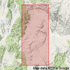
[Named from prominent exposures in walls of Garley Canyon (in T. 14 S., R. 9 E., Castle Gate 15-min quadrangle), Carbon Co., Book Cliffs area, central eastern UT.]
Source: US geologic names lexicon (USGS Bull. 896, p. 802).

- Usage in publication:
-
- Garley Canyon Beds*
- Modifications:
-
- Revised
- AAPG geologic province:
-
- Paradox basin
- Wasatch uplift
- Uinta basin
Summary:
Reduced in stratigraphic rank from Garley Canyon Sandstone Member of the Mancos Shale to Garley Canyon Beds of Emery Sandstone Member of the Mancos shale throughout its areal extent (northwest part of Paradox basin, western Book Cliffs, and on the Wasatch Plateau of the Wasatch uplift). Is lithologically continuous with the lower part of the Emery of the Wasatch Plateau. Palynomorph fossils identified in SE1/4 SE1/4 sec 36, T13S, R9E, Carbon Co, UT in the Uinta basin.
Source: GNU records (USGS DDS-6; Denver GNULEX).
For more information, please contact Nancy Stamm, Geologic Names Committee Secretary.
Asterisk (*) indicates published by U.S. Geological Survey authors.
"No current usage" (†) implies that a name has been abandoned or has fallen into disuse. Former usage and, if known, replacement name given in parentheses ( ).
Slash (/) indicates name conflicts with nomenclatural guidelines (CSN, 1933; ACSN, 1961, 1970; NACSN, 1983, 2005, 2021). May be explained within brackets ([ ]).