The National Geologic Map Database is migrating to a new infrastructure. We apologize for any service disruptions during this process.
|
|---|


- Usage in publication:
-
- Garfield formation
- Modifications:
-
- Original reference
- Dominant lithology:
-
- Quartzite
- AAPG geologic province:
-
- Midcontinent region
Summary:
Pg. 793-799, 836-843, with maps. Garfield formation. Banded (black and red, about 1 inch wide) fine-grained, hard, cherty ferruginous quartzite, in many places highly pyritiferous. Graphitic schists usually overlie the quartzite, and are also pyritiferous. The formation is locally known as "Iron Dike," because of iron content and long dike-like outcrops. Resistant to weathering; forms a ridge. Thickness 60 feet. Older than Pluma formation and younger than Northwestern formation. Age is Precambrian. Believed to be Keewatin age (Archean). Report includes geologic map.
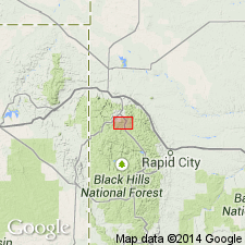
Origin of name not stated, but occurs in Lead district, Lawrence Co., southwestern SD.
Source: US geologic names lexicon (USGS Bull. 896, p. 801); supplemental information from GNU records (USGS DDS-6; Denver GNULEX).
- Usage in publication:
-
- Garfield formation
- Modifications:
-
- Areal extent
- AAPG geologic province:
-
- Midcontinent region
Summary:
Pg. 6, 14, geol. map. Garfield formation. Discussion of Galena-Roubaix district, South Dakota. In north and northwest parts of district, rocks which are described and mapped as Garfield and Northwest formations, strike northwestward toward outcrops of Garfield and Northwestern formations in Lead district. They cannot be traced directly into Lead district because of Cambrian and Tertiary igneous cover. Formation characterized by graphitic slates. Overlies Northwestern formation; underlies Pluma formation. In Lead system.
Source: US geologic names lexicon (USGS Bull. 1200, p. 1471).
For more information, please contact Nancy Stamm, Geologic Names Committee Secretary.
Asterisk (*) indicates published by U.S. Geological Survey authors.
"No current usage" (†) implies that a name has been abandoned or has fallen into disuse. Former usage and, if known, replacement name given in parentheses ( ).
Slash (/) indicates name conflicts with nomenclatural guidelines (CSN, 1933; ACSN, 1961, 1970; NACSN, 1983, 2005, 2021). May be explained within brackets ([ ]).