The National Geologic Map Database is migrating to a new infrastructure. We apologize for any service disruptions during this process.
|
|---|


- Usage in publication:
-
- Garfield formation
- Modifications:
-
- Original reference
- Dominant lithology:
-
- Conglomerate
- Quartzite
- Sandstone
- Shale
- Limestone
- AAPG geologic province:
-
- Eagle basin
- Piceance basin
Summary:
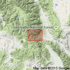
Pg. 66. Garfield formation. In descending order: (1) dominantly quartzite with subordinate shale beds; (2) dominantly shale with some quartzite; (3) chiefly limestone with interstratified black shale, 200 feet; (4) black shale with thin strata of quartzite and impure limestone, 700 feet; (5) quartzite and conglomerate, 30 feet. Total thickness 2,600 to 2,800 feet. Overlies Ouray limestone (Mississippian to Devonian), with apparent conformity. Unconformably underlies Kangaroo formation. Fossils [listed]. Age is Pennsylvanian.
Named from town of Garfield, Monarch-Tomichi region, Chaffee Co., central CO.
Source: US geologic names lexicon (USGS Bull. 896, p. 801).
- Usage in publication:
-
- Garfield formation
- Modifications:
-
- Not used
Summary:
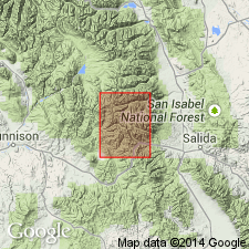
Name not used. Was applied to lower 2,600 to 2,800 ft of Pennsylvanian rocks in the Monarch-Tomichi areas, CO. Lower 1,100 ft of original Garfield reassigned to Belden shale and upper 1,500+ ft of original Garfield assigned to lower part of Minturn formation. Report area shows Pennsylvanian mapped (geologic map) as Belden shale and Minturn formation in Chaffee Co, Eagle basin and Gunnison Co in Piceance basin.
Source: GNU records (USGS DDS-6; Denver GNULEX).
For more information, please contact Nancy Stamm, Geologic Names Committee Secretary.
Asterisk (*) indicates published by U.S. Geological Survey authors.
"No current usage" (†) implies that a name has been abandoned or has fallen into disuse. Former usage and, if known, replacement name given in parentheses ( ).
Slash (/) indicates name conflicts with nomenclatural guidelines (CSN, 1933; ACSN, 1961, 1970; NACSN, 1983, 2005, 2021). May be explained within brackets ([ ]).