The National Geologic Map Database is migrating to a new infrastructure. We apologize for any service disruptions during this process.
|
|---|


- Usage in publication:
-
- Gardar Formation
- Modifications:
-
- Revised
- AAPG geologic province:
-
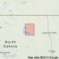
- Williston basin
Summary:
Revised in that Gardar Formation of Coleharbor Group locally overlies the newly named Churchs Ferry Formation of the Coleharbor Group. Underlies Dahlen Formation of Coleharbor. Does not have as large (81) percentage of shale in Ramsey Co as it does (95) in eastern Cavalier Co, ND. Is widespread in northeastern two-thirds of Ramsey Co. Generally 30+/-ft thick; maximum thickness of 200 ft. Occurs as valley fill. Probably deposited after a period of erosion between glaciations. Of Pleistocene age. Geologic maps; cross sections.
Source: GNU records (USGS DDS-6; Denver GNULEX).
For more information, please contact Nancy Stamm, Geologic Names Committee Secretary.
Asterisk (*) indicates published by U.S. Geological Survey authors.
"No current usage" (†) implies that a name has been abandoned or has fallen into disuse. Former usage and, if known, replacement name given in parentheses ( ).
Slash (/) indicates name conflicts with nomenclatural guidelines (CSN, 1933; ACSN, 1961, 1970; NACSN, 1983, 2005, 2021). May be explained within brackets ([ ]).